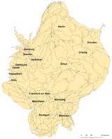
As part of our ongoing DFG-funded research project on the effects of High-Speed Rail (HSR) lines on urban development and current dissertations at the chair, we have constructed a database of interregional rail connections in Germany and neighbouring countries during the timespan of 1990 to 2030, assuming that all planned rail projects of the current German Federal Transport Infrastructure Plan (Bundesverkehrswegeplan, BVWP) are implemented. The database has been used for two research papers currently in preparation, focusing on two often used indicators to measure accessibility: gravitational accessibility of population, and degree centrality within the rail network (a graph-based measure).
However, the database allows the calculation of other, simlarly interesting and relevant accessibility measures: closeness centrality, betweenness centrality, and daily accessibility. It also enables us to implement illustrative visualisations of the development of rail accessibility in Germany in the form of so-called "time-space maps", time-based anamorphic cartograms, based on multidimensional scaling algorithms. Even if these results are not (yet) included in journal publications, they might be of interest for both the research community and the general public as well. They are hence included in a new working paper published on this website, which will be updated as the project continues.
We are looking forward to discuss our findings and visualisations with our interested readers!
The Working Paper can be found here.
Contact:
Fabian Wenner, f.wenner@tum.de
Johannes Moser, johannes.moser@tum.de