Designbased analysis
In the designbased analysis of landscape structures, spatial characteristics, spatial coherences and spatial boundaries are described as landscape. The conceptual brainstorming in the research for new settlement structures relies on their potentials.


Design
In the phase of design, a regional landscape or a 'regional' topic is chosen for the landscape. Based on a spatial structure and shape, overarching designs are developed.
Bachelor


Master


landschaftBLAU
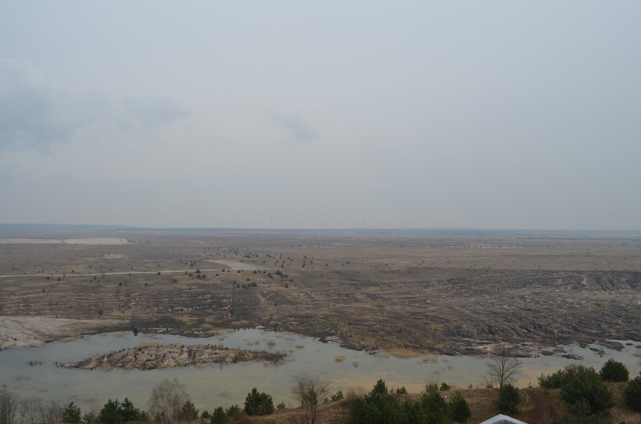
Open-cast lignite mining changed the Lausitz region profoundly in the 20th century. In the process mining also brought prosperity and work to the region. After the end of coal funding, new areas are built - dominated in the Lausitz by new bodies of water created by controlled flooding during recultivation. In this way, a landscape with completely new water systems develops - and dependencies that bring unimagined challenges with them. But developments of the landscape in the Lausitz have not only been determined by major technical transformation processes since the modern era.
Based on natural conditions, the human being has been influencing the landscape for centuries - not only in the Lausitz region - through technical development processes: he creates 'cultural landscapes'. Landscape areas that we call 'nature' nowadays were created in earlier epochs for survival and economic activity and incidentally generated a high level of biodiversity. An example of this is the Spreewald, which was cultivated by the Sorbs from the Middle Ages onwards.
Especially in the Lausitz region, such technogenic landscapes are visible - through current as well as historical 'management' of the soil and water. Currently, active open-cast mining/ lignite mining is particularly well known, which has negative effects on groundwater and the ecology of the water system in addition to its climatic impacts. The historical interventions were not as radical and rapid, but they also changed the landscapes through technical measures. Ponds were created early on in today's Lausitzer Heath and Pond Landscape and forests were cleared or areas were overused by grazing in order to cultivate the soil. Today, this landscape is protected as a biosphere reserve.
QUESTION.
In the design project, the landscape of the Lausitz region is rethought and newly developed starting from the water system - as large and small transformation processes of water landscapes and, concomitantly, as a constant negotiation of "nature", "culture" and "technology". The mining lakes become part of a larger landscape system of rivers, ponds, canals, moors and valleys. Each structure can be the starting point of a new conception.
The technical and biological recultivation of the post-mining areas is ensured by the Federal Mining Act. But what atmosphere will define the new landscape - what will the new landscape look like? The area of conflict extends from idyllic vacation landscapes to agricultural land and inaccessible wilderness. And how can the landscape not only follow an ideal image, but remain open to its own natural dynamics as a process in the making? How can the new developments affect the historical technogenic water landscapes and the water system and how can the developments be influenced, starting not only from 'fixing the problem' but also from using the potentials? What new connections, or thinking from the point of the water: what spatial connections will there be as a consequence?
AIM.
The Lausitz is a transnational region in Germany (Brandenburg and Saxony) and Poland, divided into the areas of Niederlausitz, Oberlausitz and Lausitzer Mountains. We are mainly concerned with the diversity of landscape areas and water as a formative element of the different landscapes in a transnational way: Spreewald, Oberlausitzer Heath and Pond Landscapes, Lausitzer Basin and Heathland, The Lausitz Lake Land as a post-mining landscape, etc. The specific area will be developed in the process of the project.