STUDIO City under – Regensburg floodable
River landscapes with their floodplains and adjacent cities represent an attractive mixture of diverse, high-quality recreational and leisure opportunities. The location close to the waterfront also harbours dangers, most frequently in form of flooding. Dykes protect settlements against flooding and reduce the risk of damage to buildings and infrastructure. However, the only protect locally against flooding and relocate the problem further downstream. The preservation of floodplains and the relocation of dykes further away from the river make a major contribution to flood protection along an entire river. Conflicts of interest between urban development, flood protection, agriculture, and nature conservation regarding the available space along rivers often make the preservations of floodplains and the relocation of dykes difficult. The ban of building in floodplains under the 2009 Federal Water Act increases this conflict potential further. A flood-adapted urban development could help to resolve the conflict of interest. There are already numerous examples around the world that showcase flood-adapted urban development and how the open space in floodplains can be designed and realised. The resulting floodable urban neighbourhoods offer the opportunity to develop floodplains as new urban districts without compromising the effectiveness of the floodplain for the river landscape.
The studio “City under – Regensburg floodable” deals with the key question: How can floodable urban quarters be designed, that high-quality open spaces are created, capable of tolerating temporary flooding, but at the same time also provides solutions for increasingly dry summers and periods of drought?
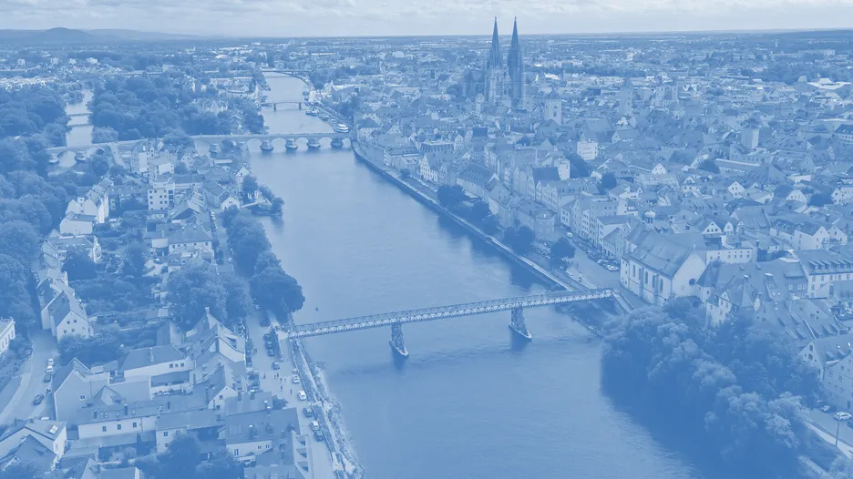
Project area
Regensburg is one of the fastest growing cities in Germany. As part of the 2017 “Wohnbaukampagne”, different areas within the city of Regensburg have been identified that are suitable for densification, conversion or new development and offer potential for up to 9,000 residential units. One of those potential new housing areas, “Weichs-Ost” is located between exiting housing and business neighbourhoods in the Regensburg district of Reinhausen at the north shore of the river Danube. The site is 14 hectares in size. The area as marked as a HQ-100 floodplain with floods rising between 2 and 4 meters high and is currently in agricultural use. In the middle of the plot grows a large tree population. At its fringe is a scrap yard located. The area is framed by the dyke in the south, the Walhalla-Alley in the north, the business park in the east and the housing neighbourhood in the west.
The project area is currently designated as a HQ100 area with flood depths of 2 to 4 metres. The flood season generally extends from February to April and June to August. During frequent flood events (HQ frequent), which occur approximately every 10 years, the water level is 3.5 metres higher than the average level of the Danube, and during a 100-year flood (HQ100) it is even 4.2 metres higher, which means that large parts of the project area are flooded.
Modules
Master Landscape Architecture Project:
15 ECTS
LV-Nr.: 0000002226
LV-Nr.: 0000002227 (Continuation)
Bachelor Landscape Architecture Project 4:
9 ECTS / 6 SWS
LV-Nr.: 0000002135
Bachelor Thesis:
LV-Nr.: 0000002168
(GTLA Forschungsdesigns)
Location
Freising, E42 [MA] - O5 [BA]
Kick Off
22.04.2024, 13:00, U10
Excursion
29.04. - 30.04.2024
Language
German/English
Tutoring
Mondays, 9:00-12:00 [MA] - 13:00-18:00 [BA]
Teaching team
Prof. Ferdinand Ludwig,
Dipl.-Ing. Lisa Höpfl,
Christoph Fleckenstein, M.A.
Contact
christoph.fleckenstein(at)tum.de
Registration for project on TUMonline
Registration for project continuation on TUMonline