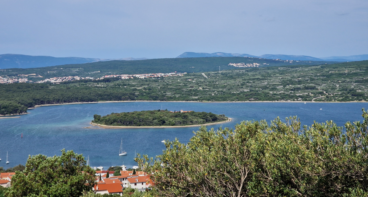
Punat View
Merlin Pott

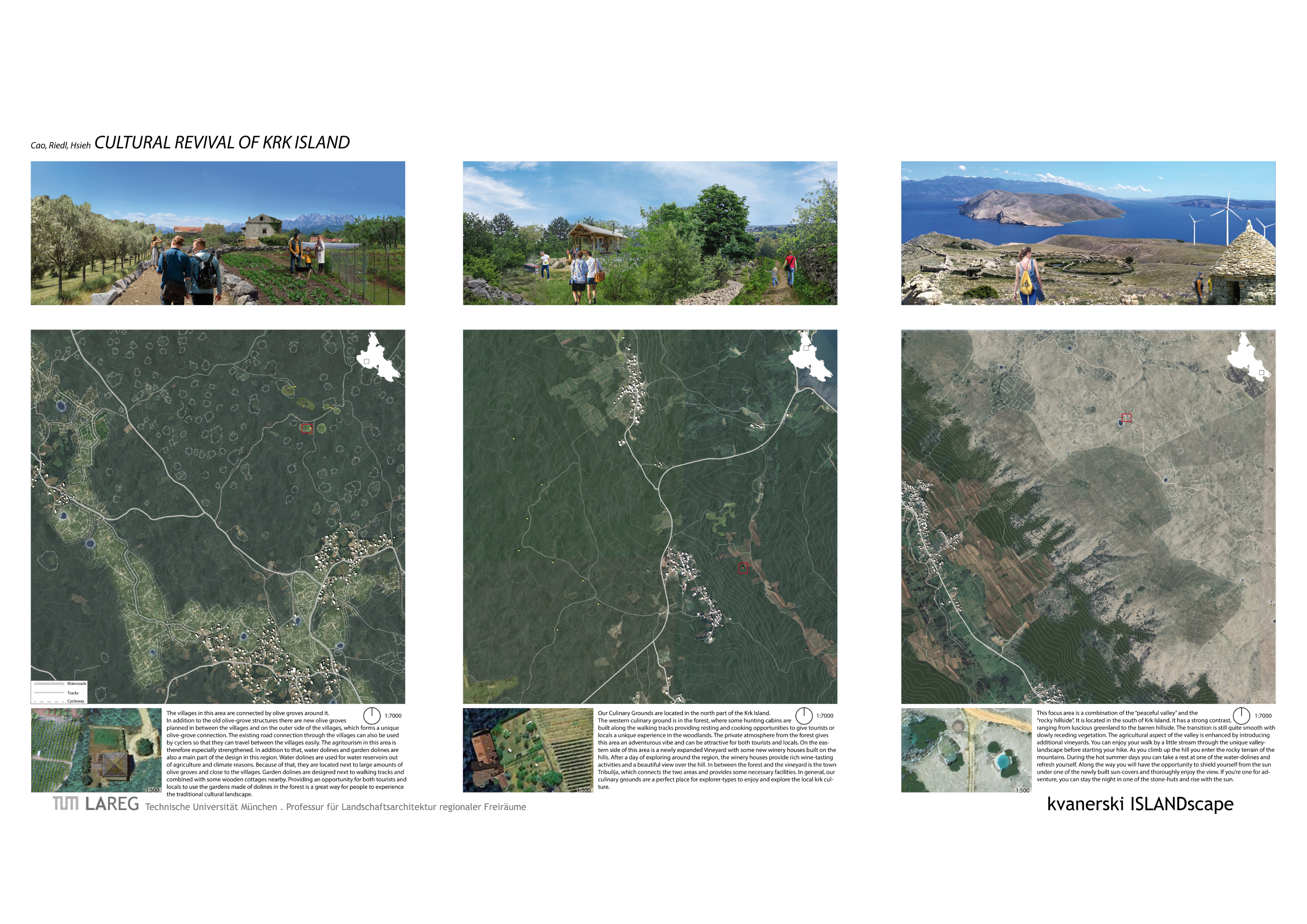
Inbetween Dry-Stone-Walls
Merlin Pott
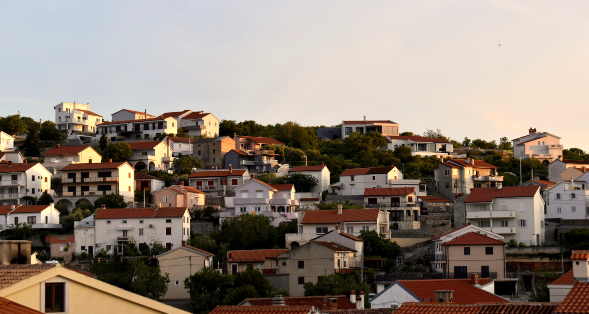
Vrbnik Apartment Settlement
Judit Thiel
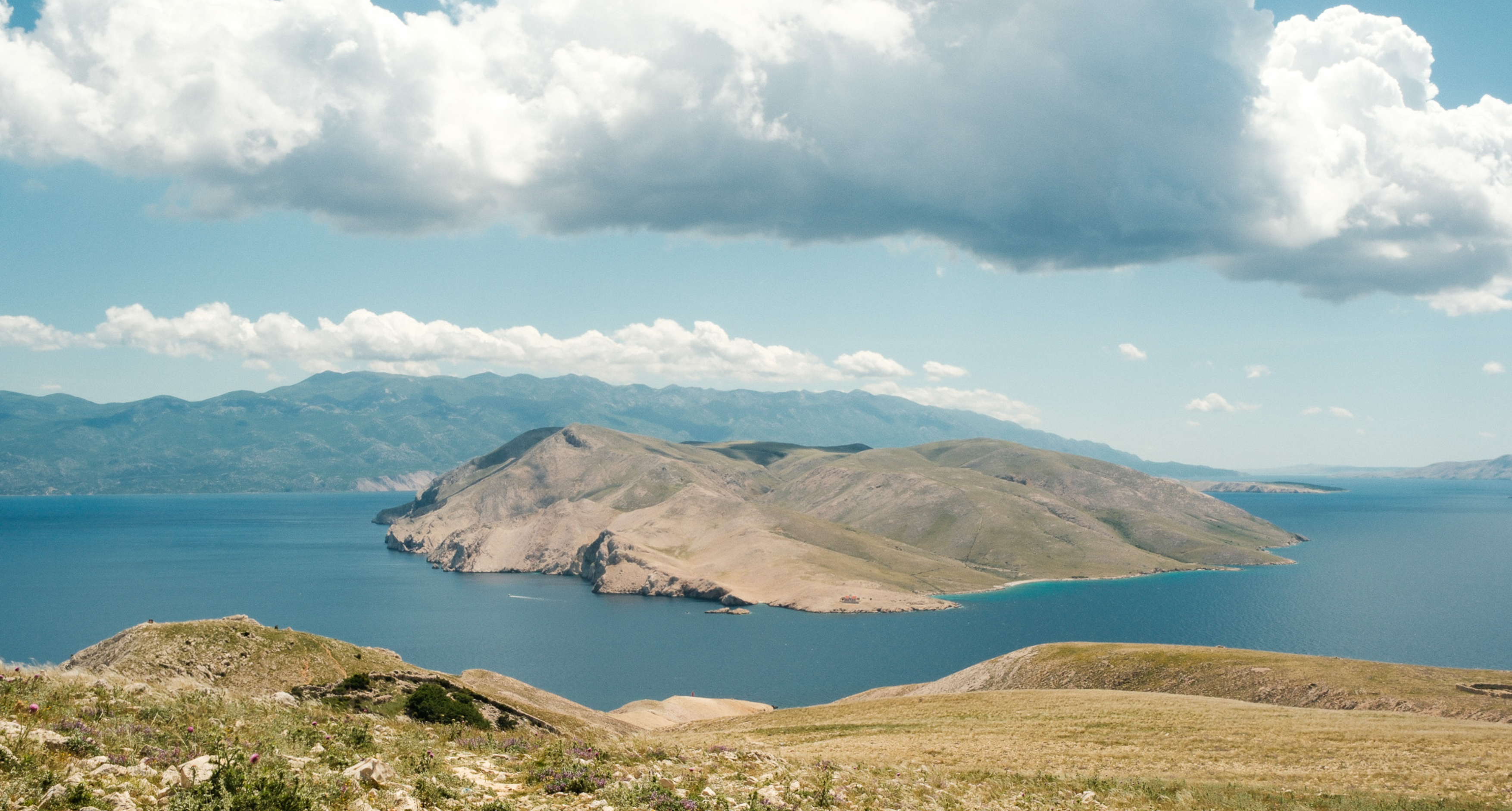
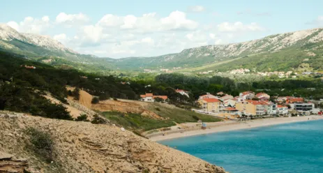
Valley of Baska
Madeline Krüger
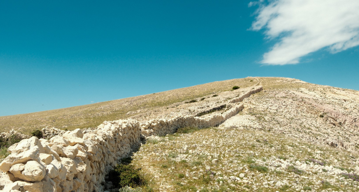
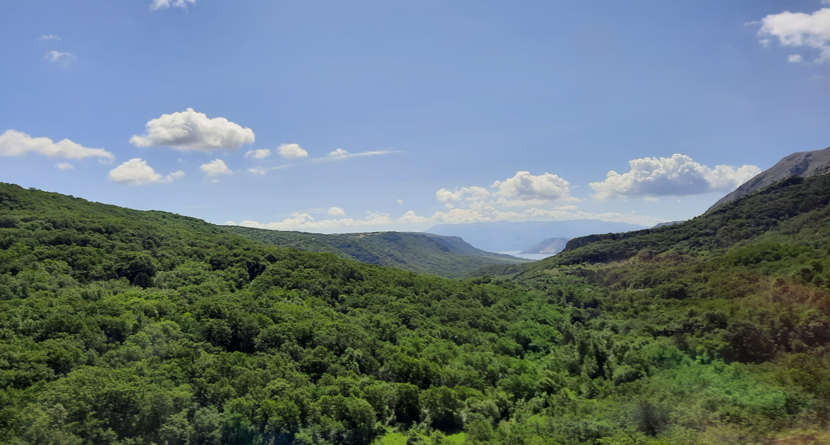
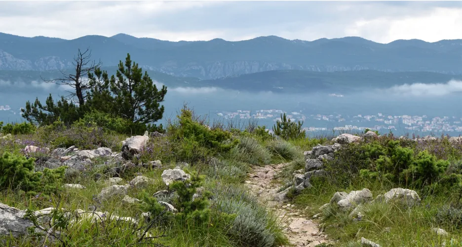
Karstic landscape
Henri Busch
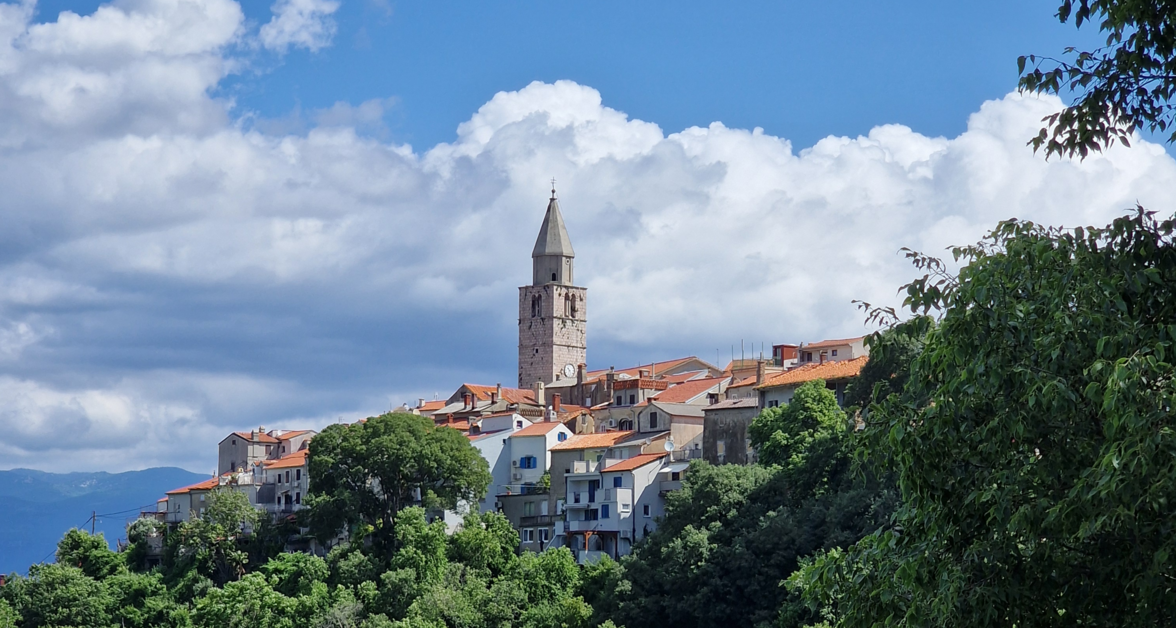
Church-Tower Vrbnik
Merlin Pott
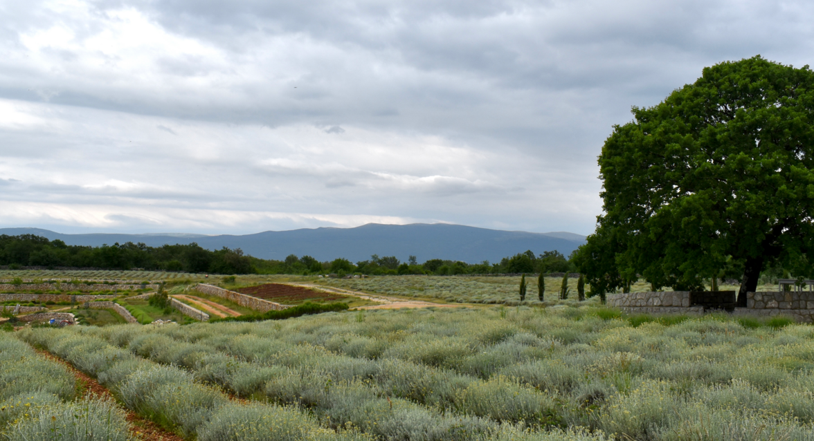
Immortelle Farm
Judit Thiel
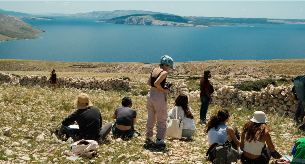
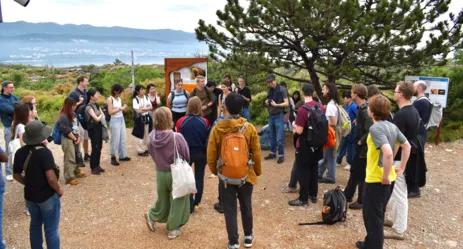
Studis in Baska
Henri Busch
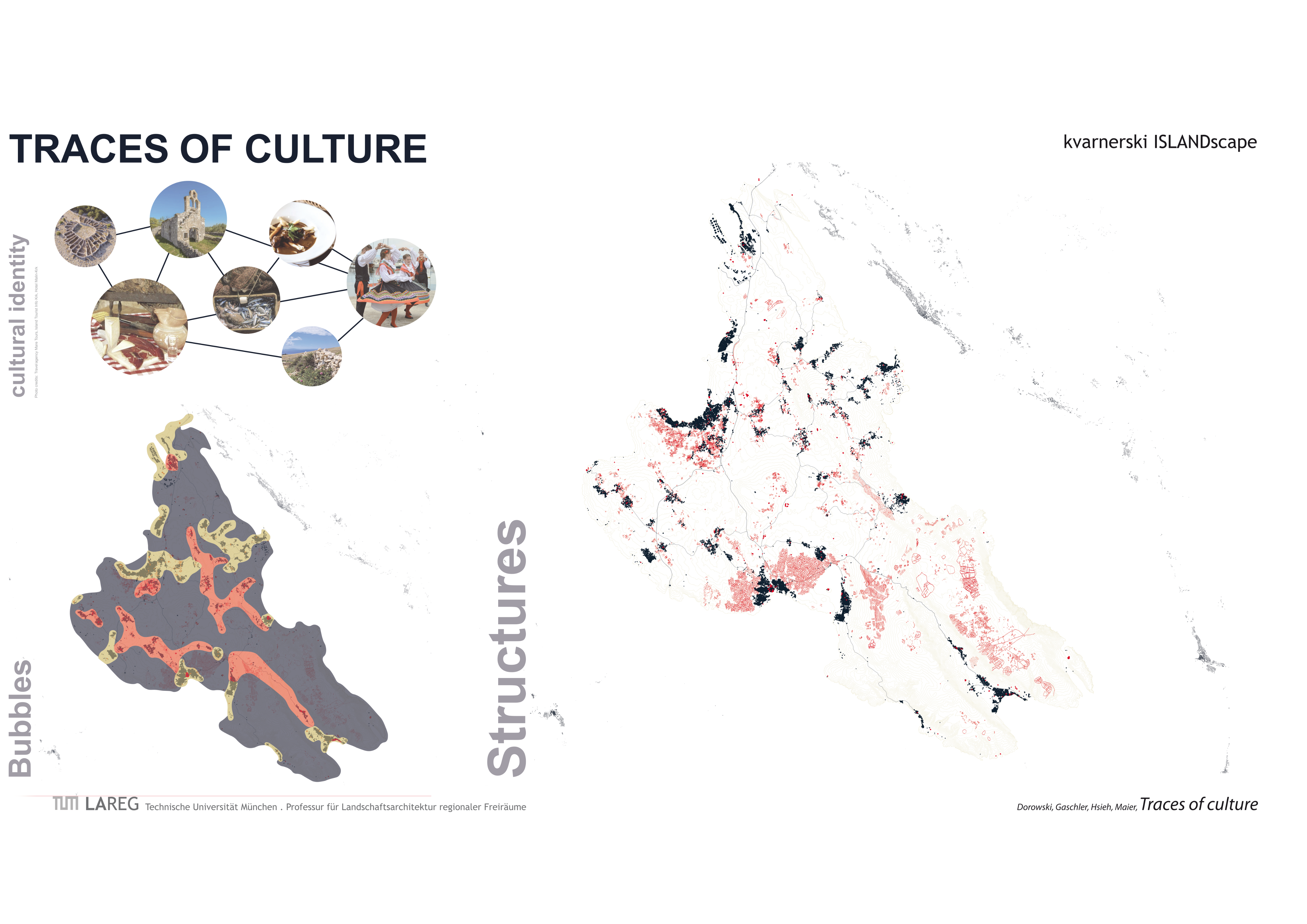
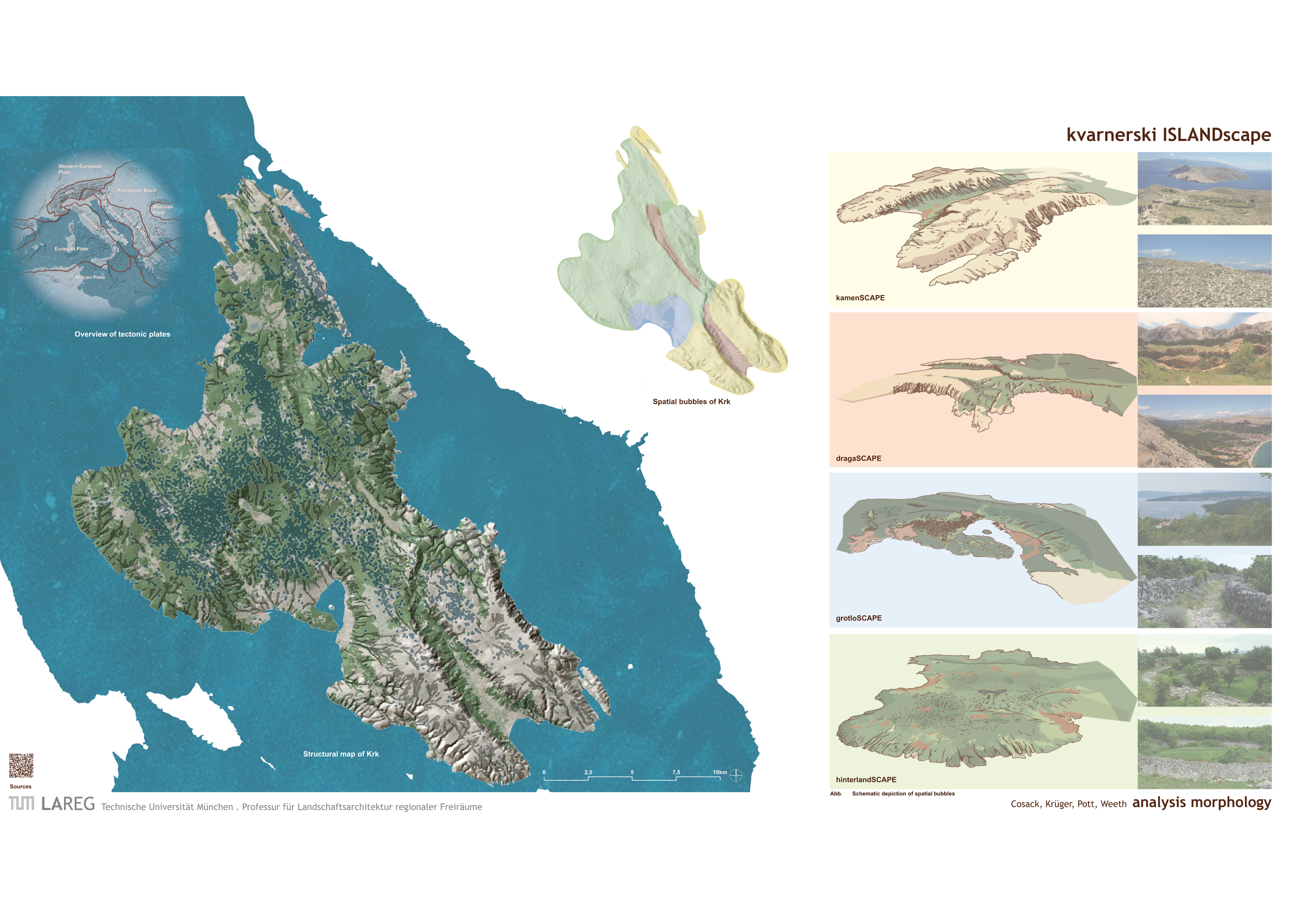
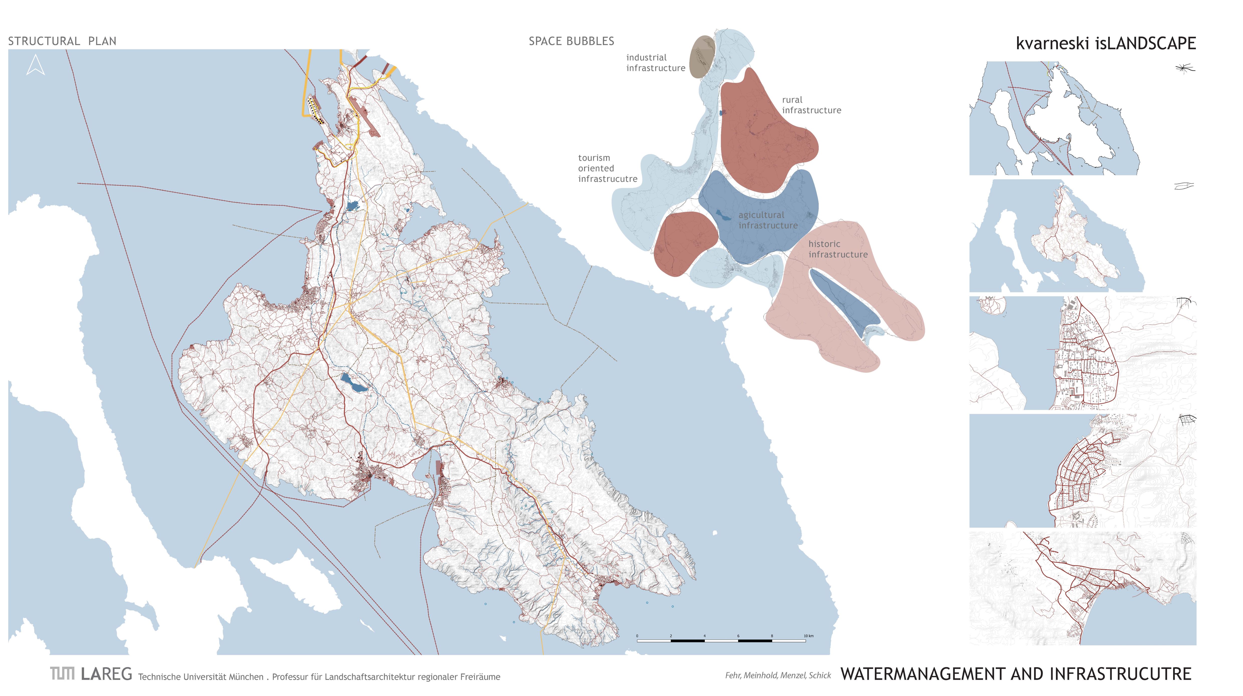
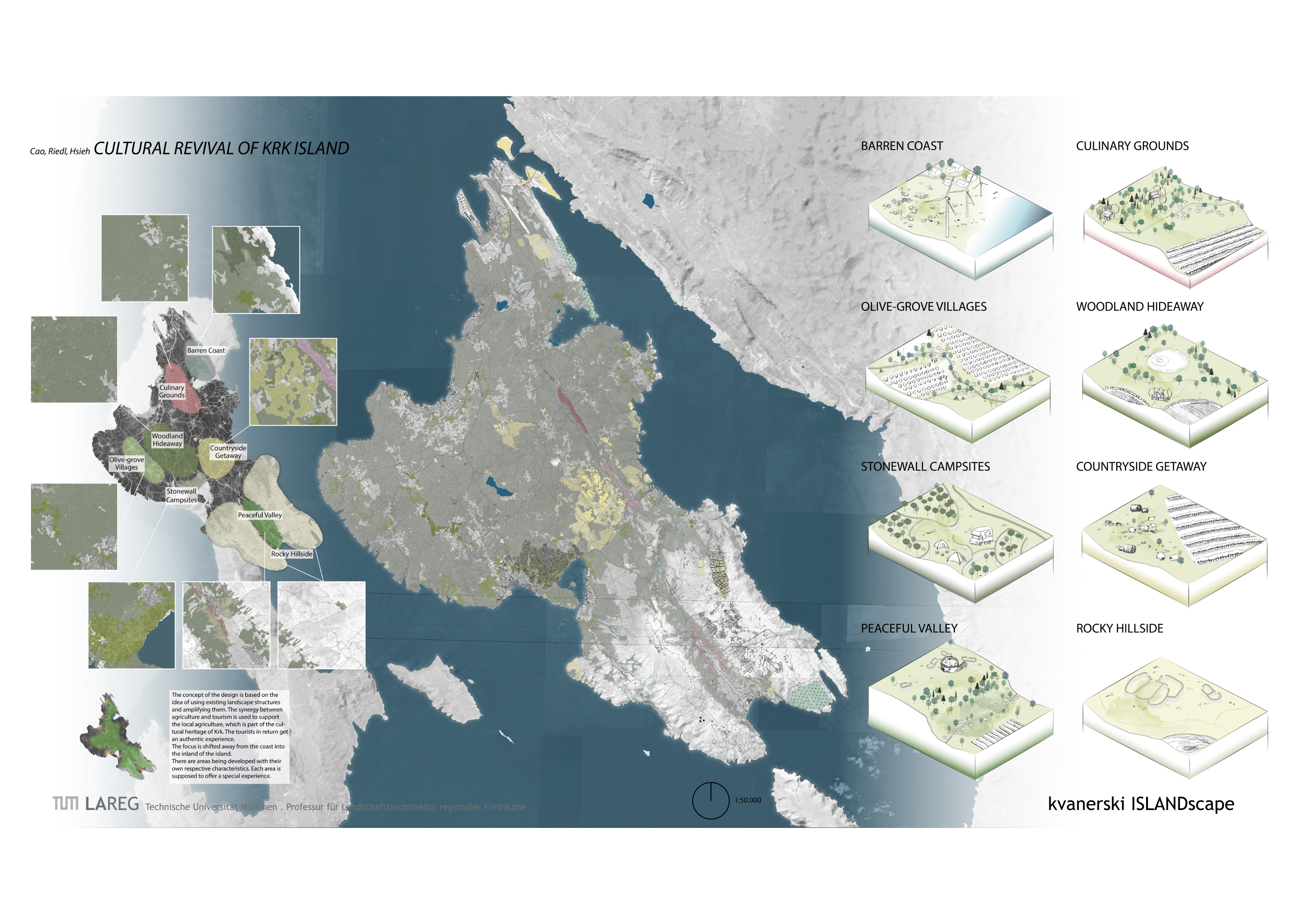
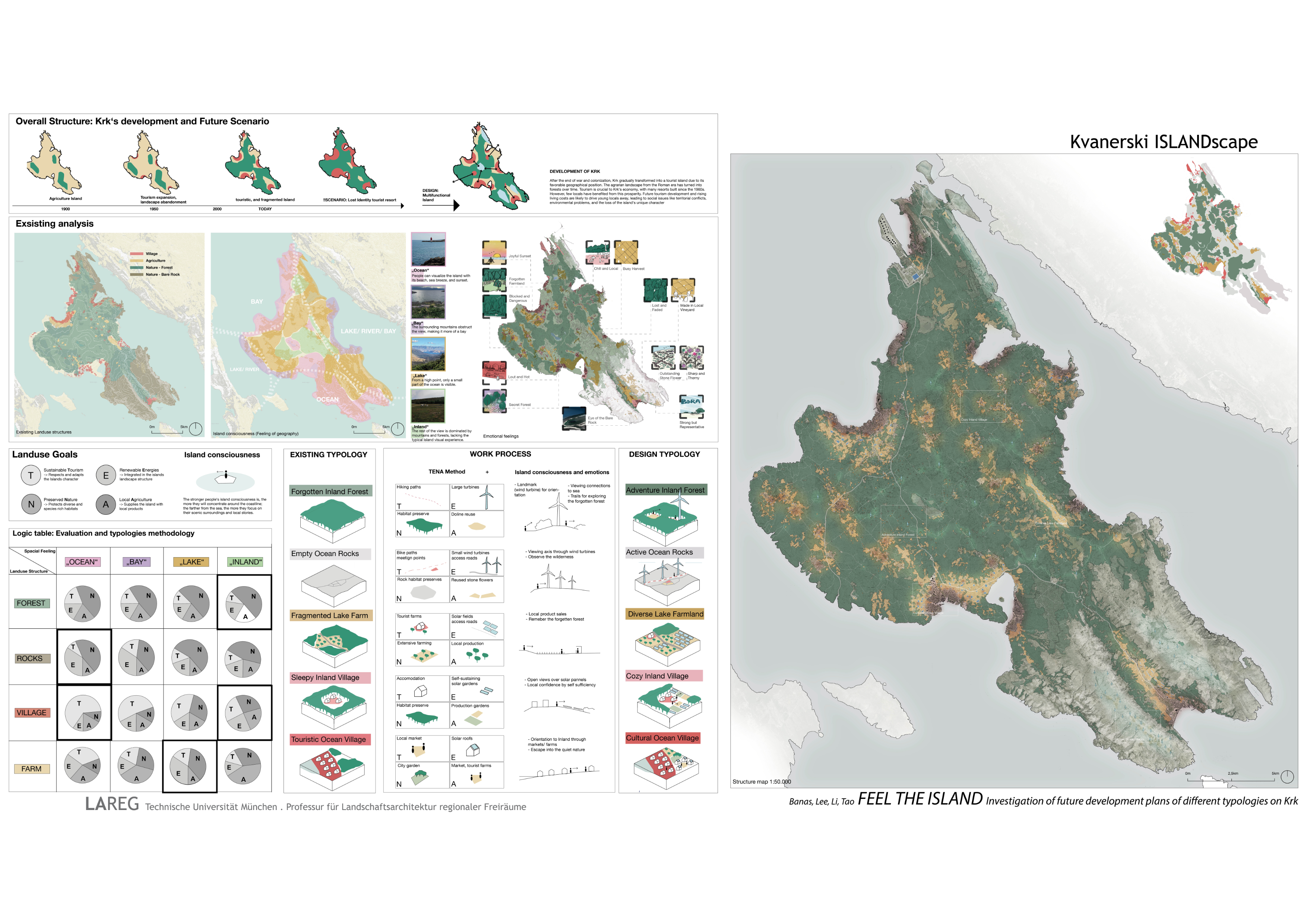
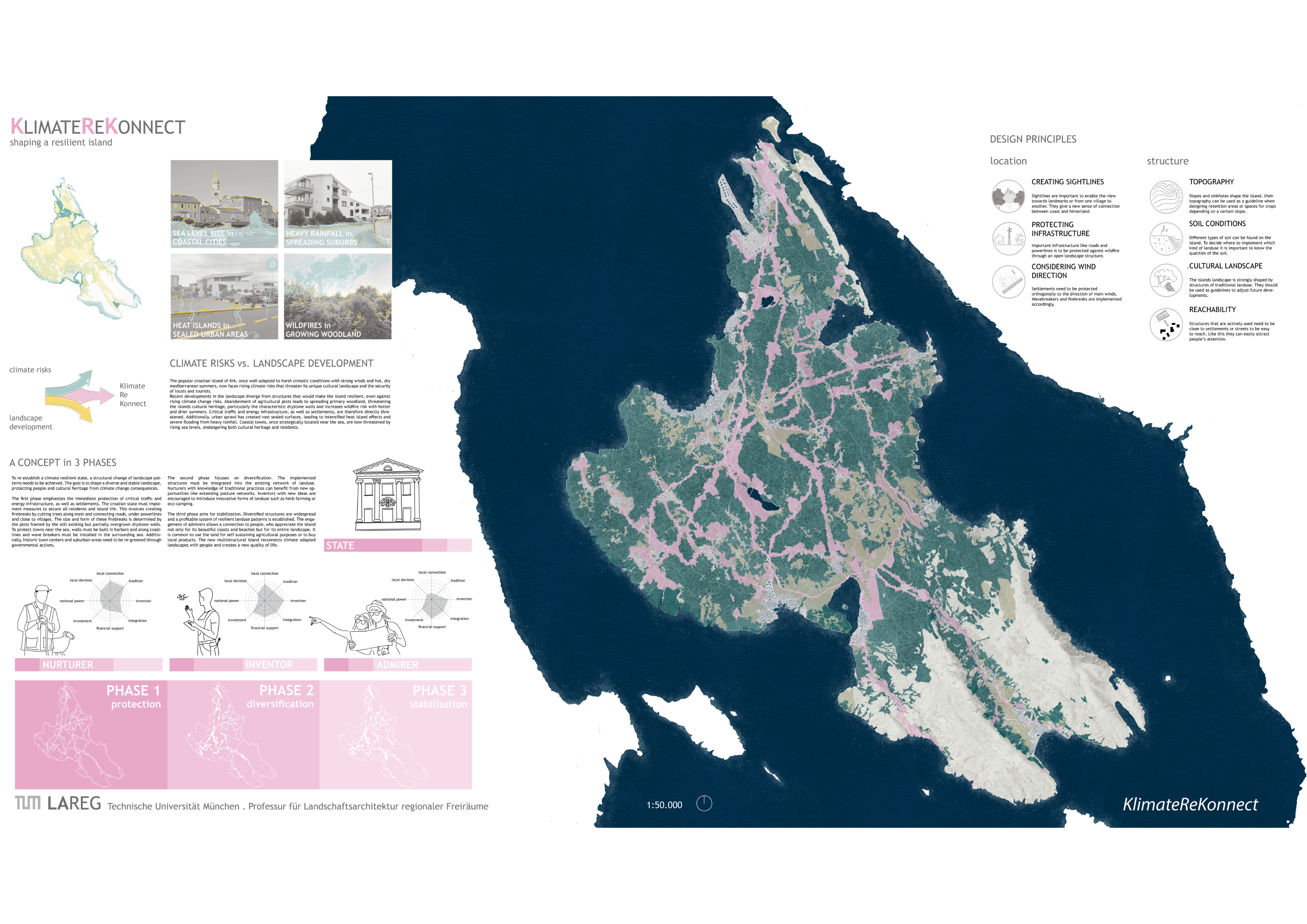
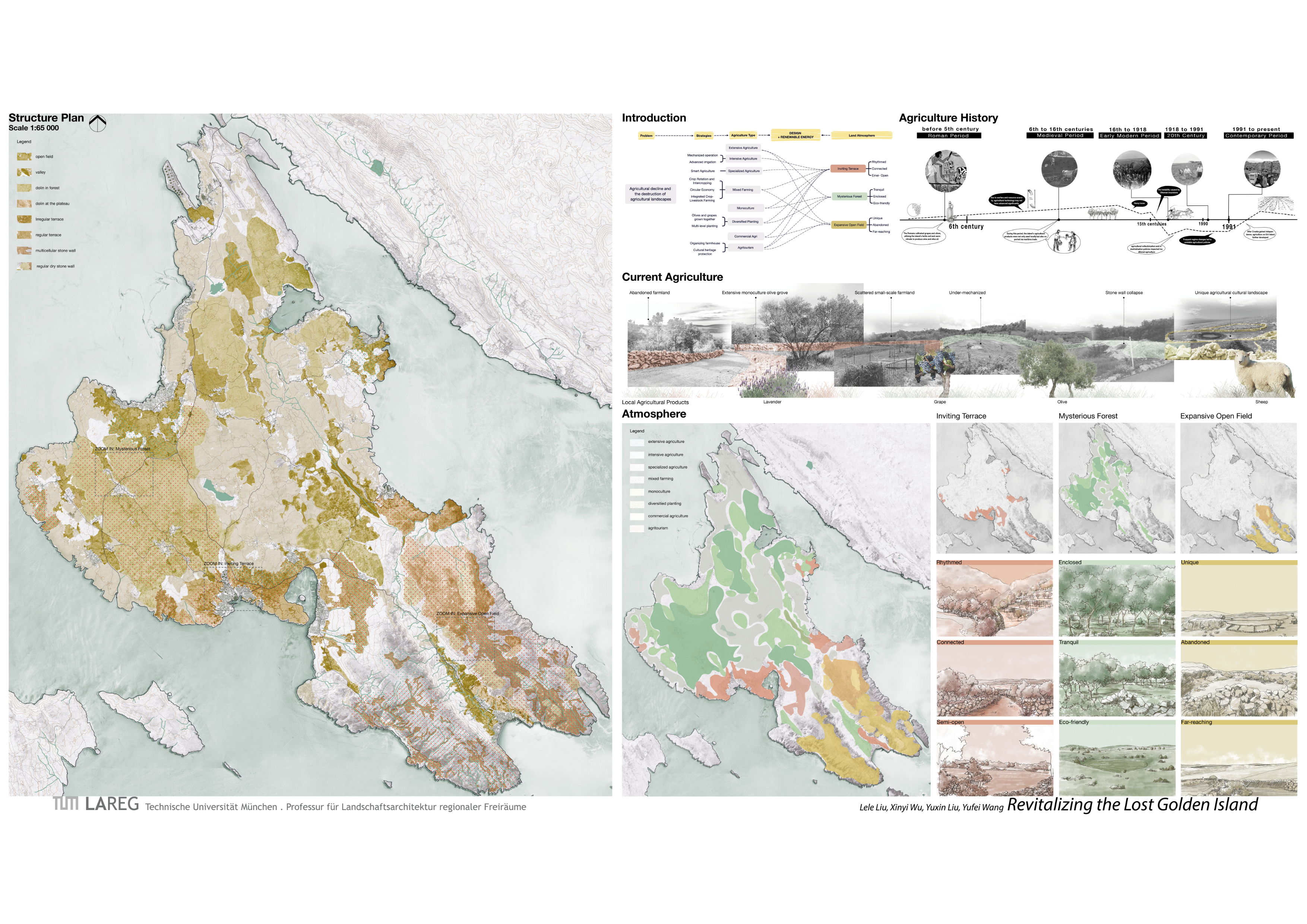
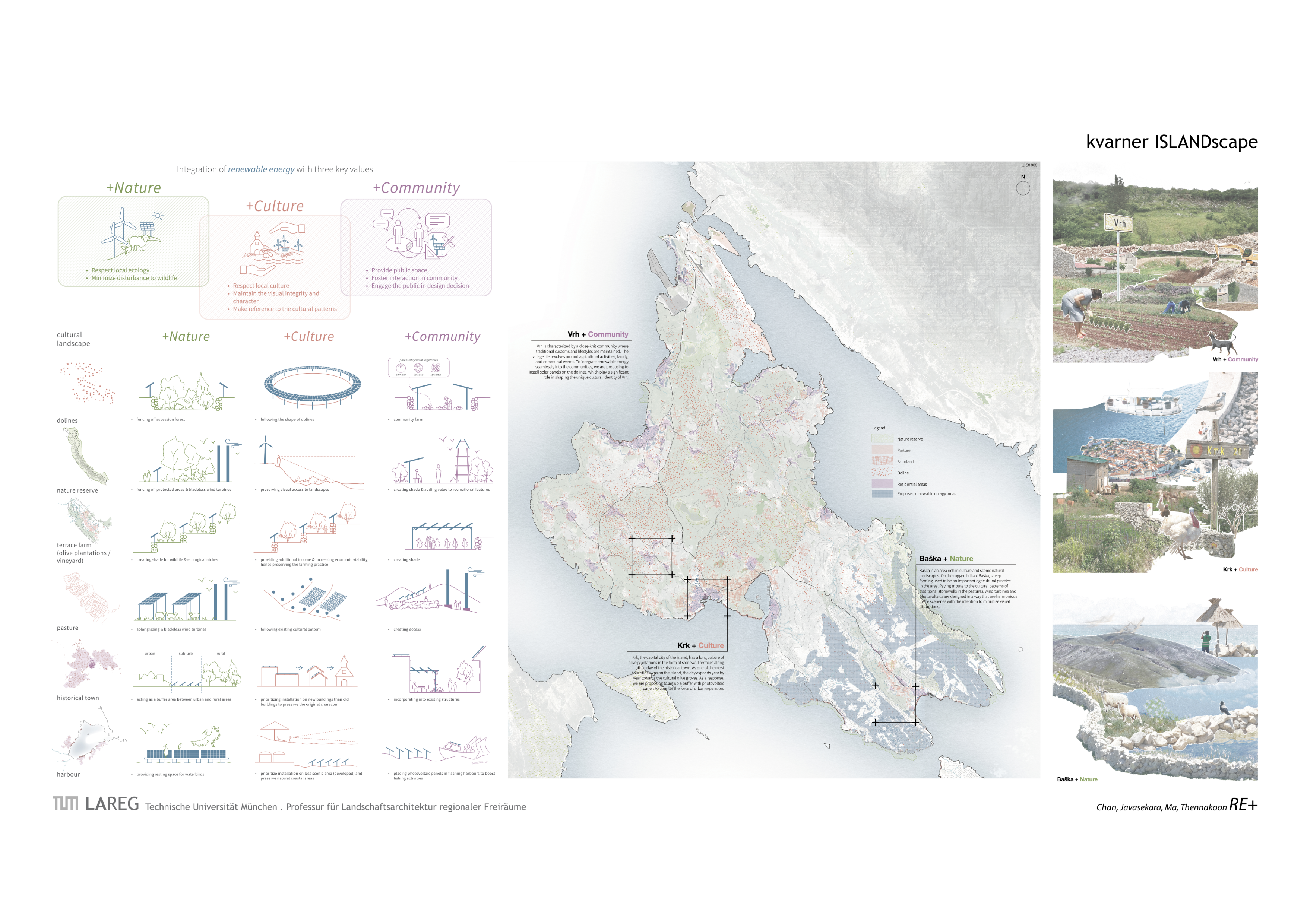
Background
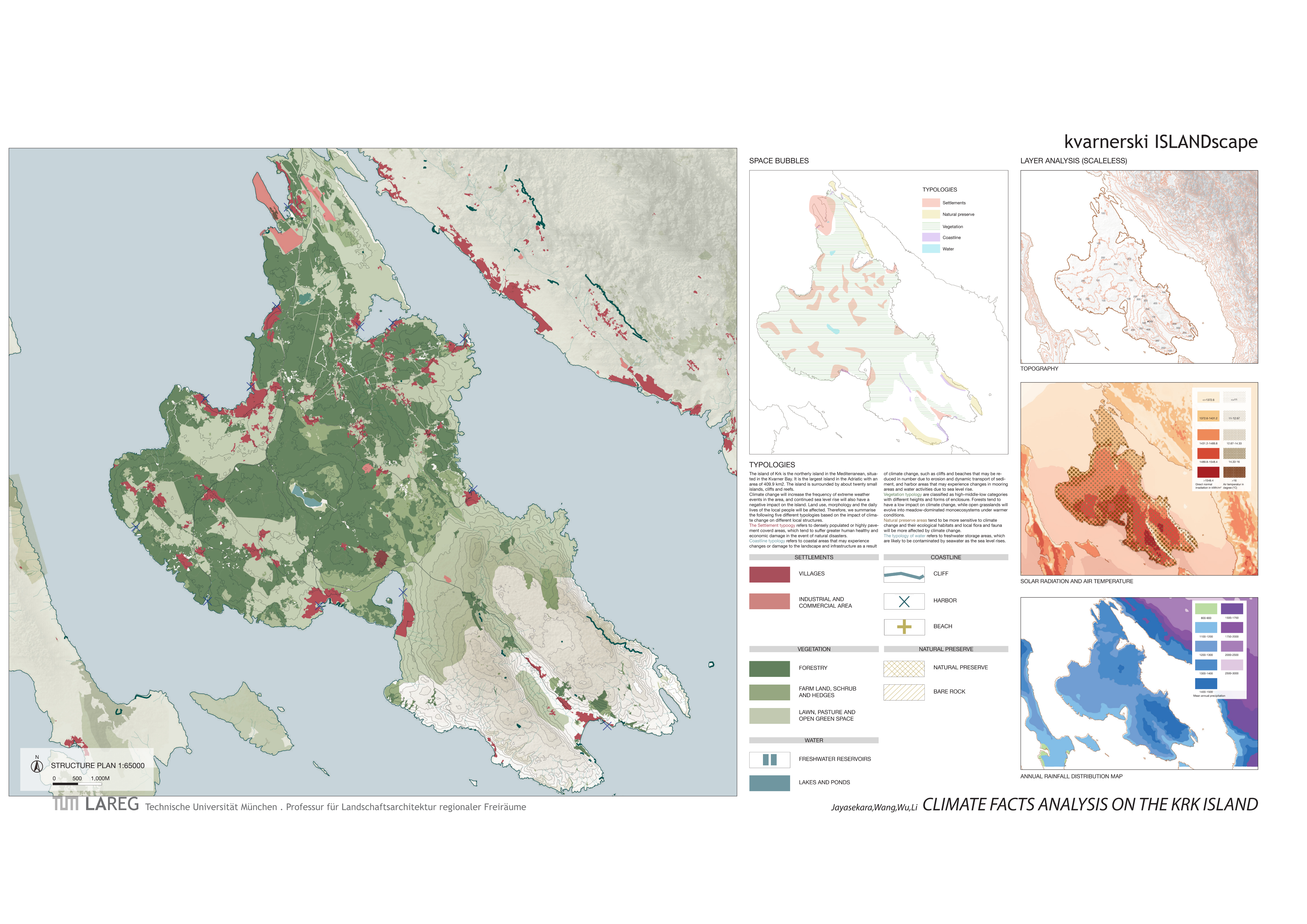
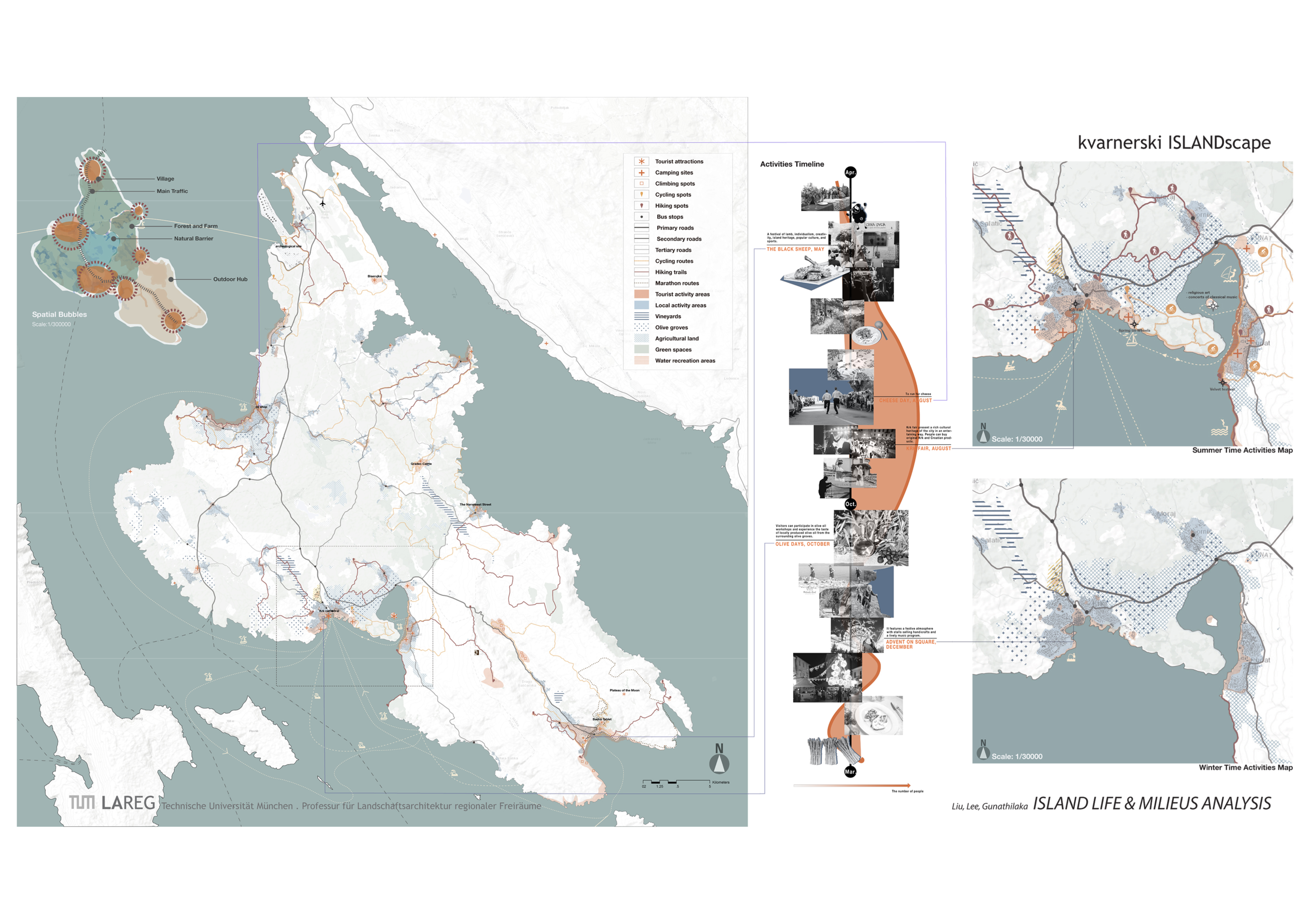
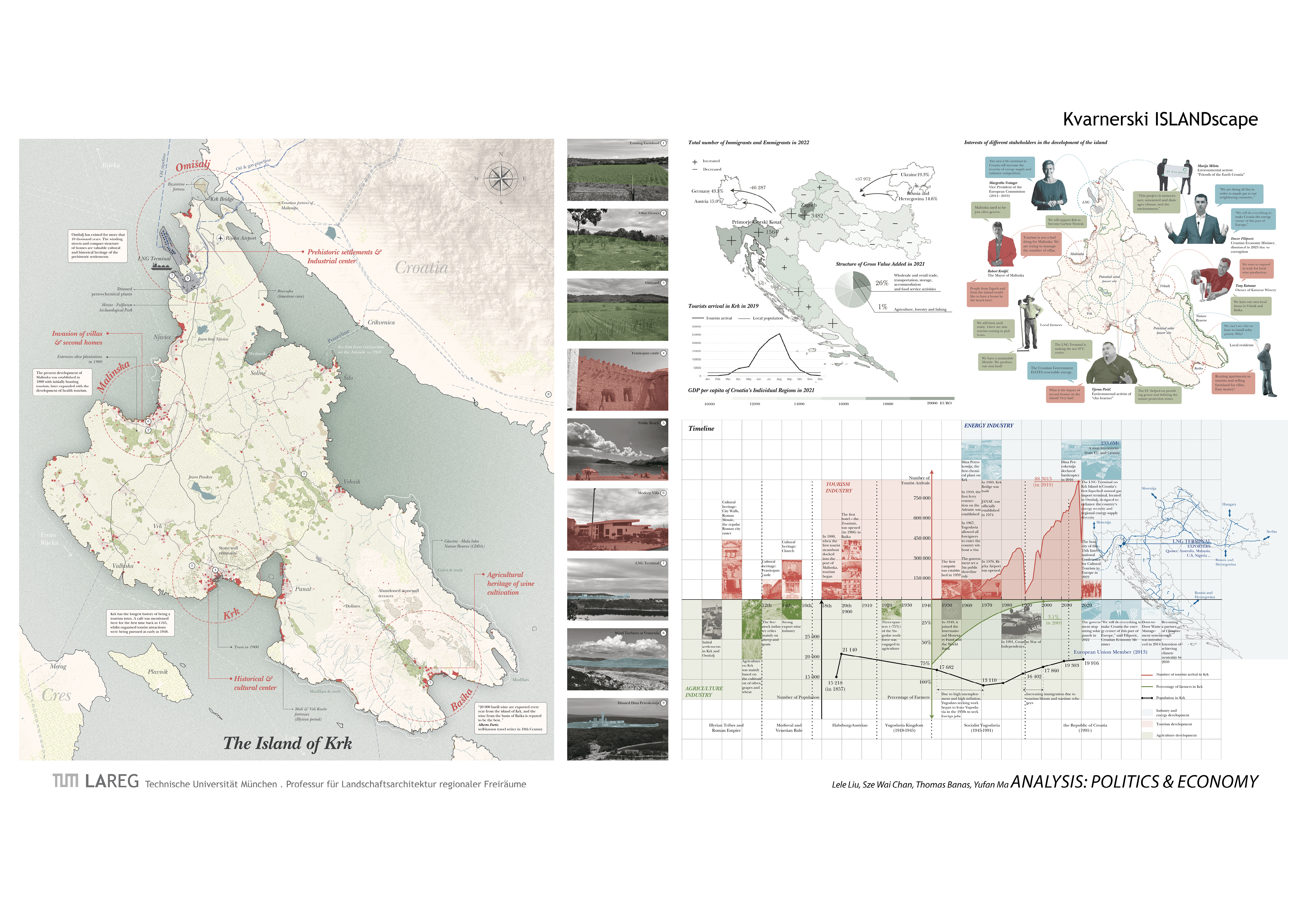
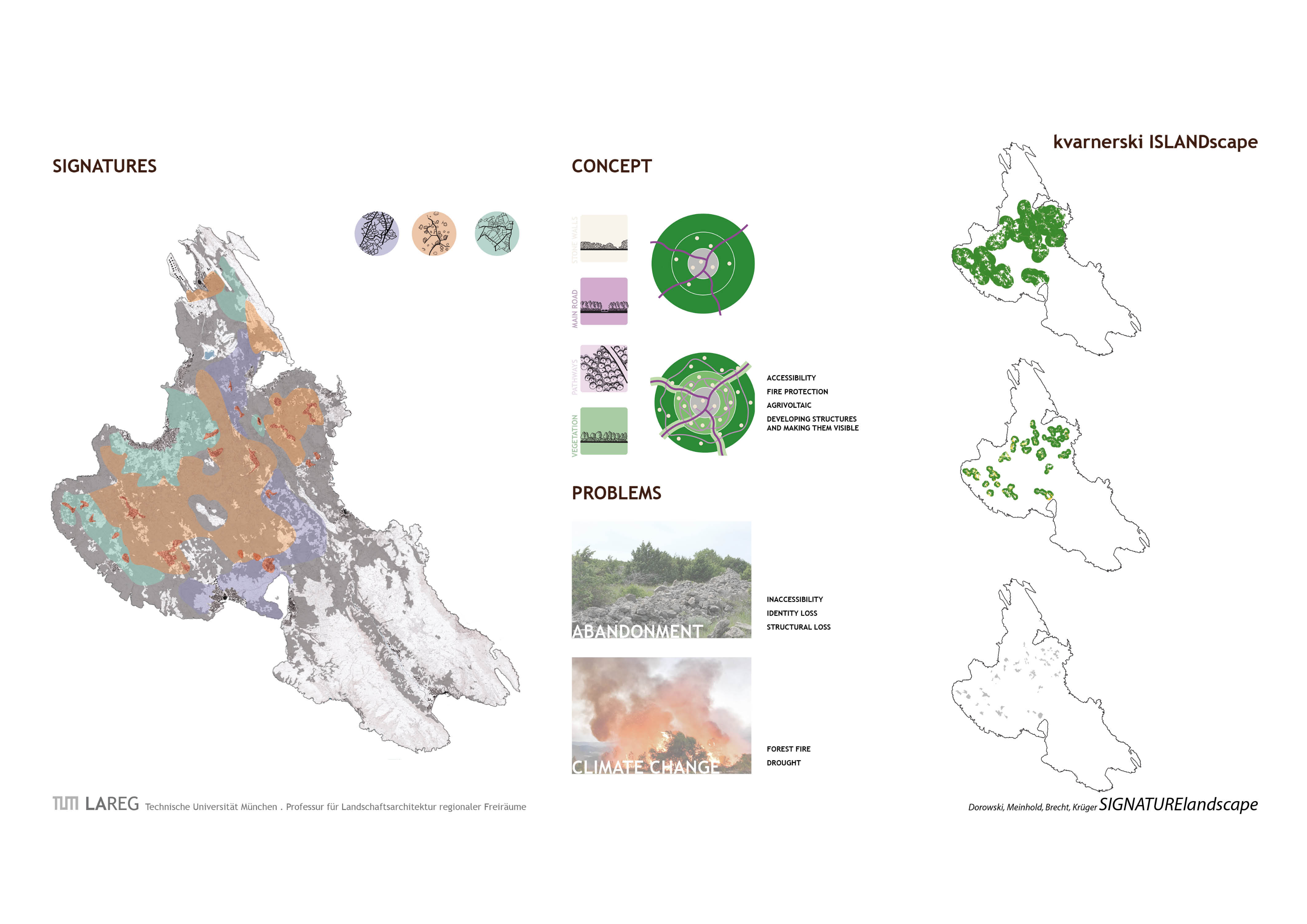
The island of Krk is the northernmost of the Croatian islands in the Adriatic Sea. Due to its location in the Bay of Kvarner, it is largely protected from the direct influences of the open sea behind other islands. It is popular and fully developed, so that tourism has become the main source of income for the approximately 17,000 inhabitants. However, the effects of climate change are becoming visible and tangible on Krk, as everywhere along the Mediterranean coastal region of Croatia.
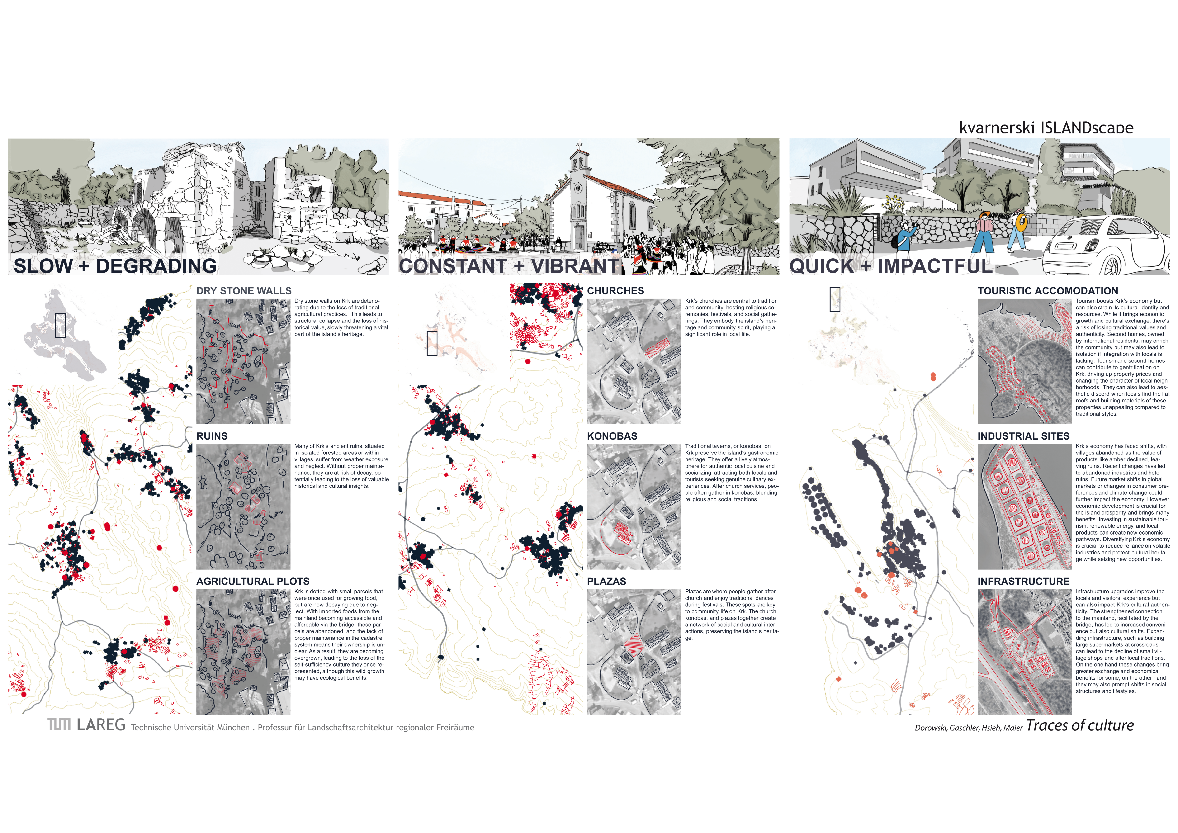
Challenges of the island
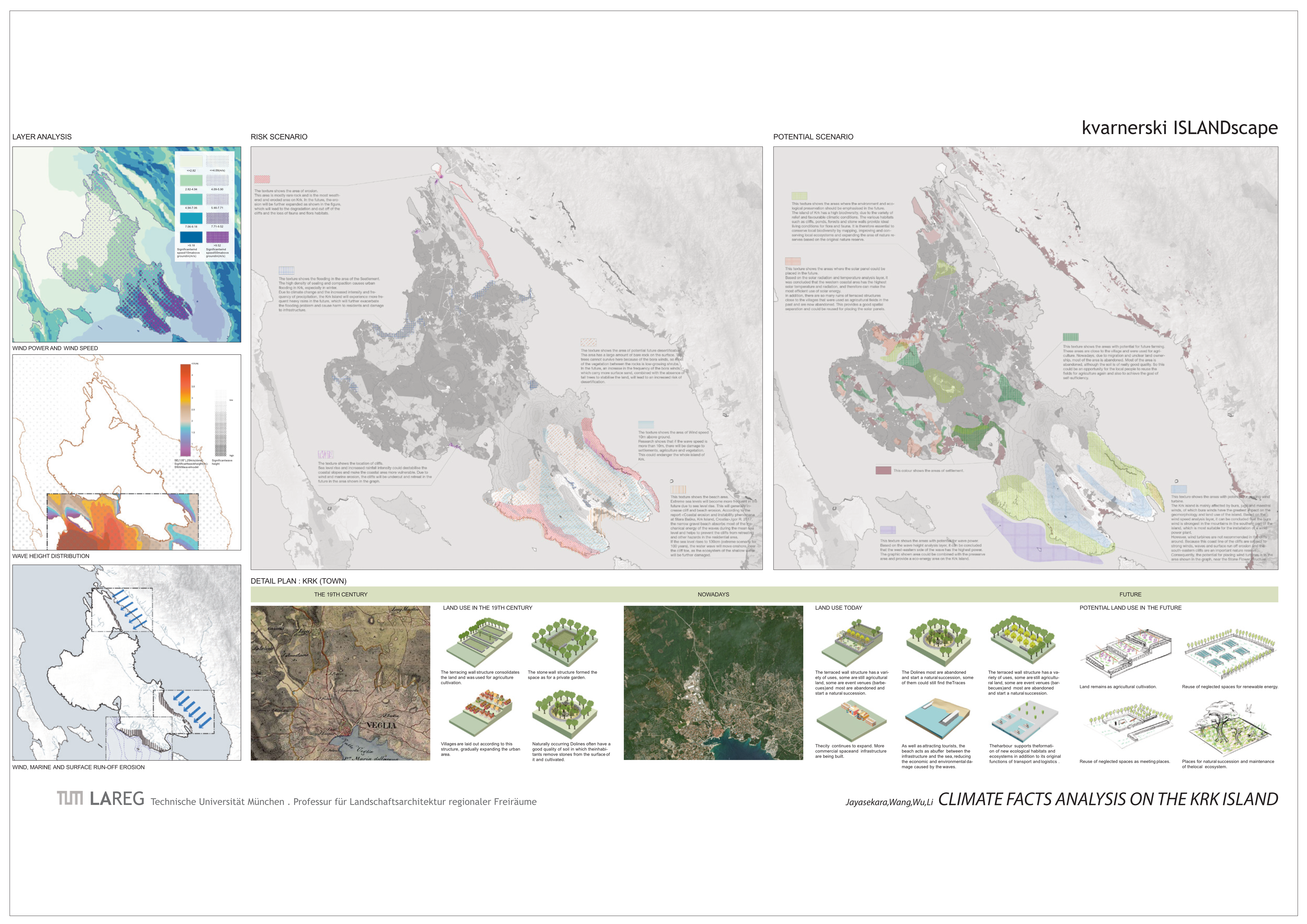
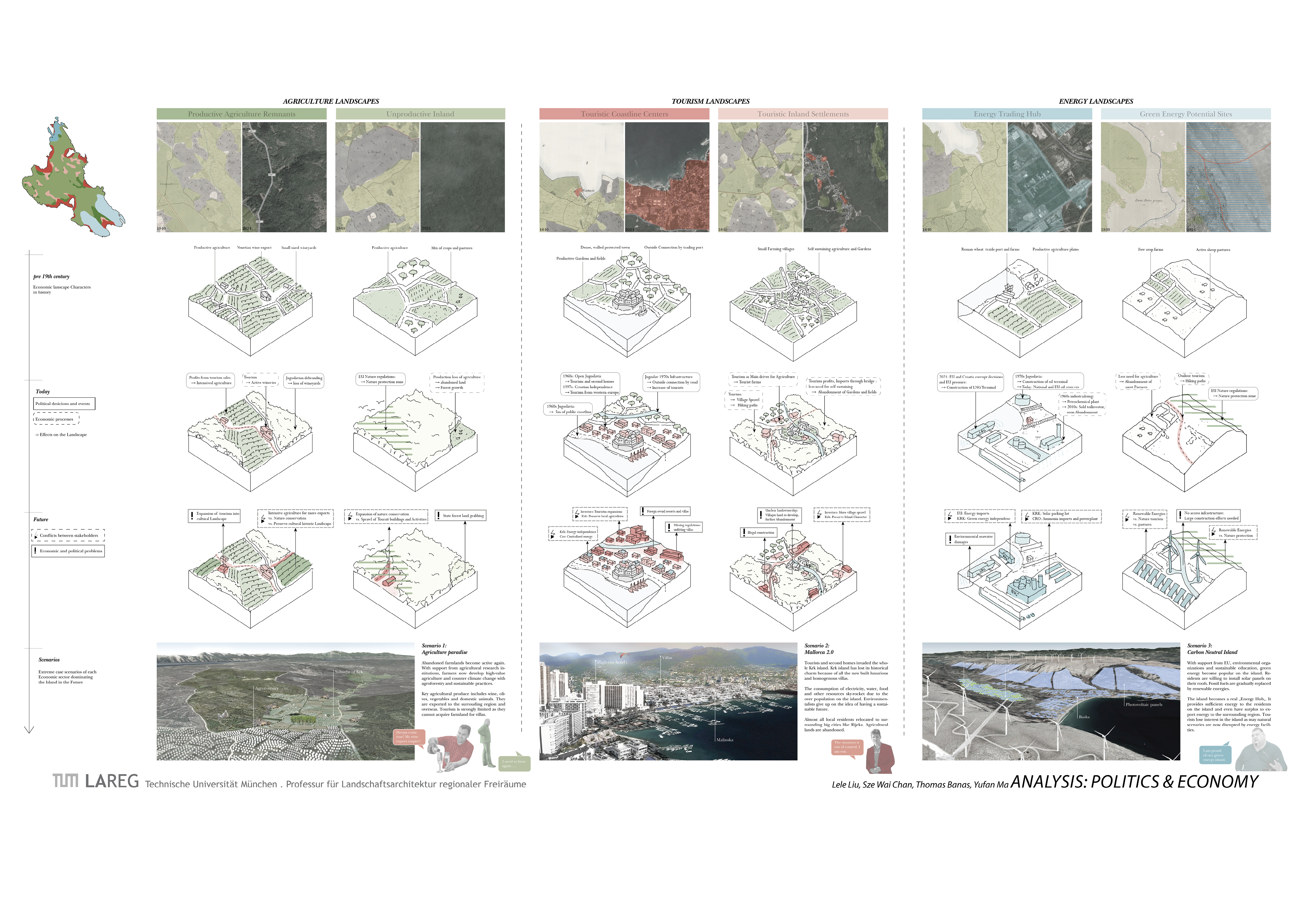
In recent decades, however, increasing urbanisation (primarily for tourism purposes) and the lack of suitable infrastructure have led to an increase in erosion processes, local coastal retreat and instability. In the course of climate change, more frequent sea level rises during extreme weather events in particular are becoming a challenge. The cultural landscape in the interior of the island will also change if water shortages occur more frequently. Agriculture, which is still small-scale today, will have to adapt to climate change, as will coastal protection measures.
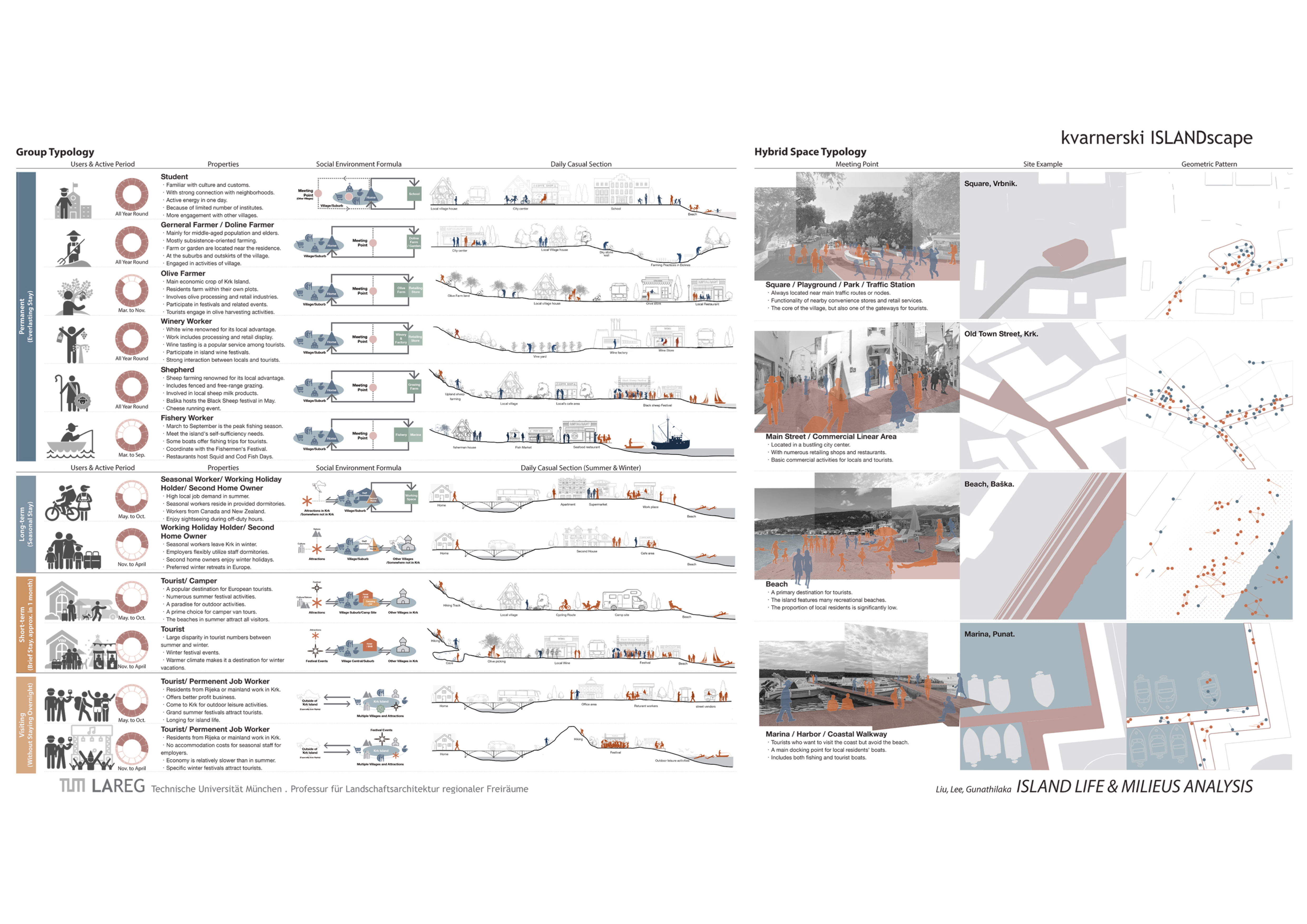
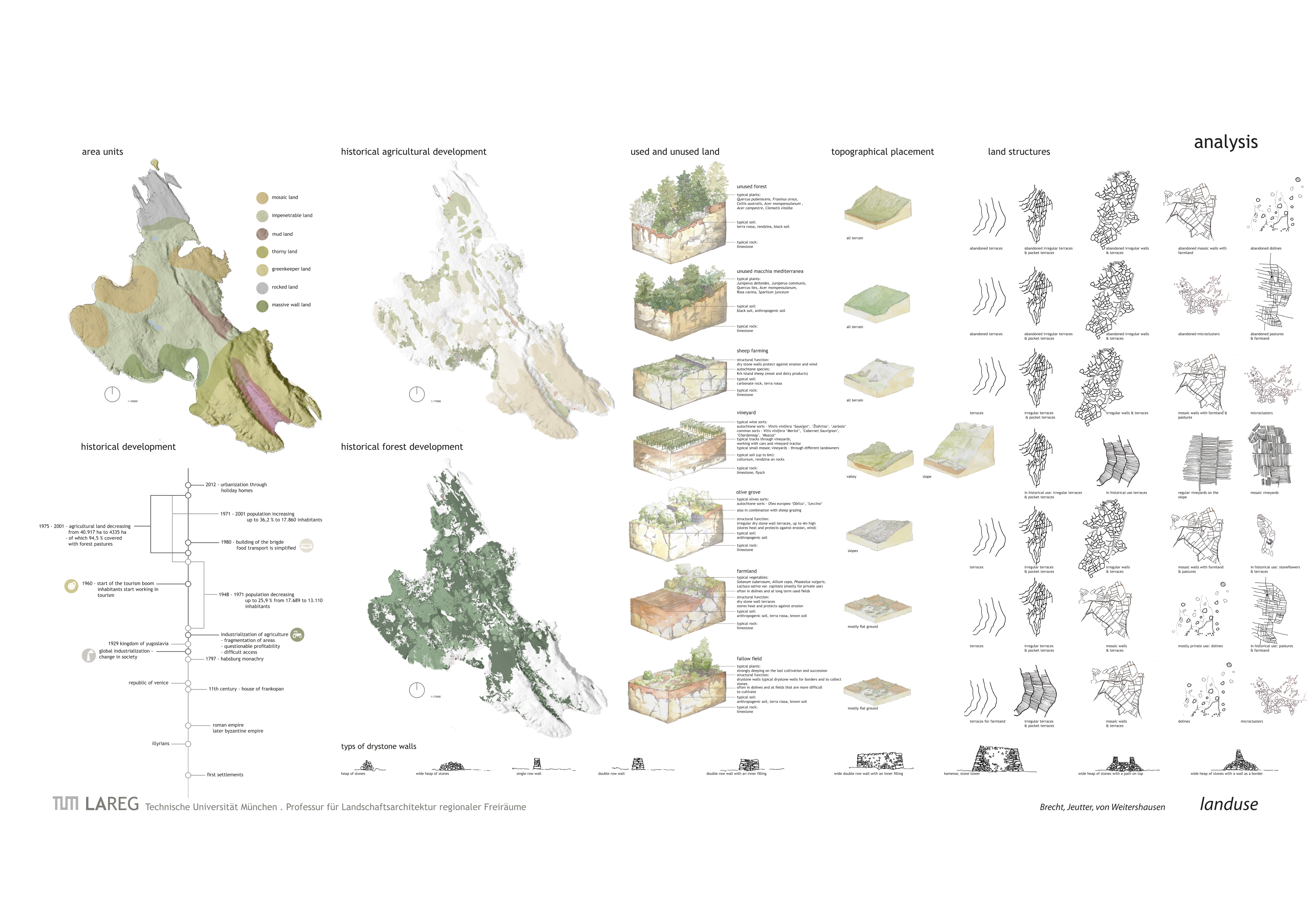
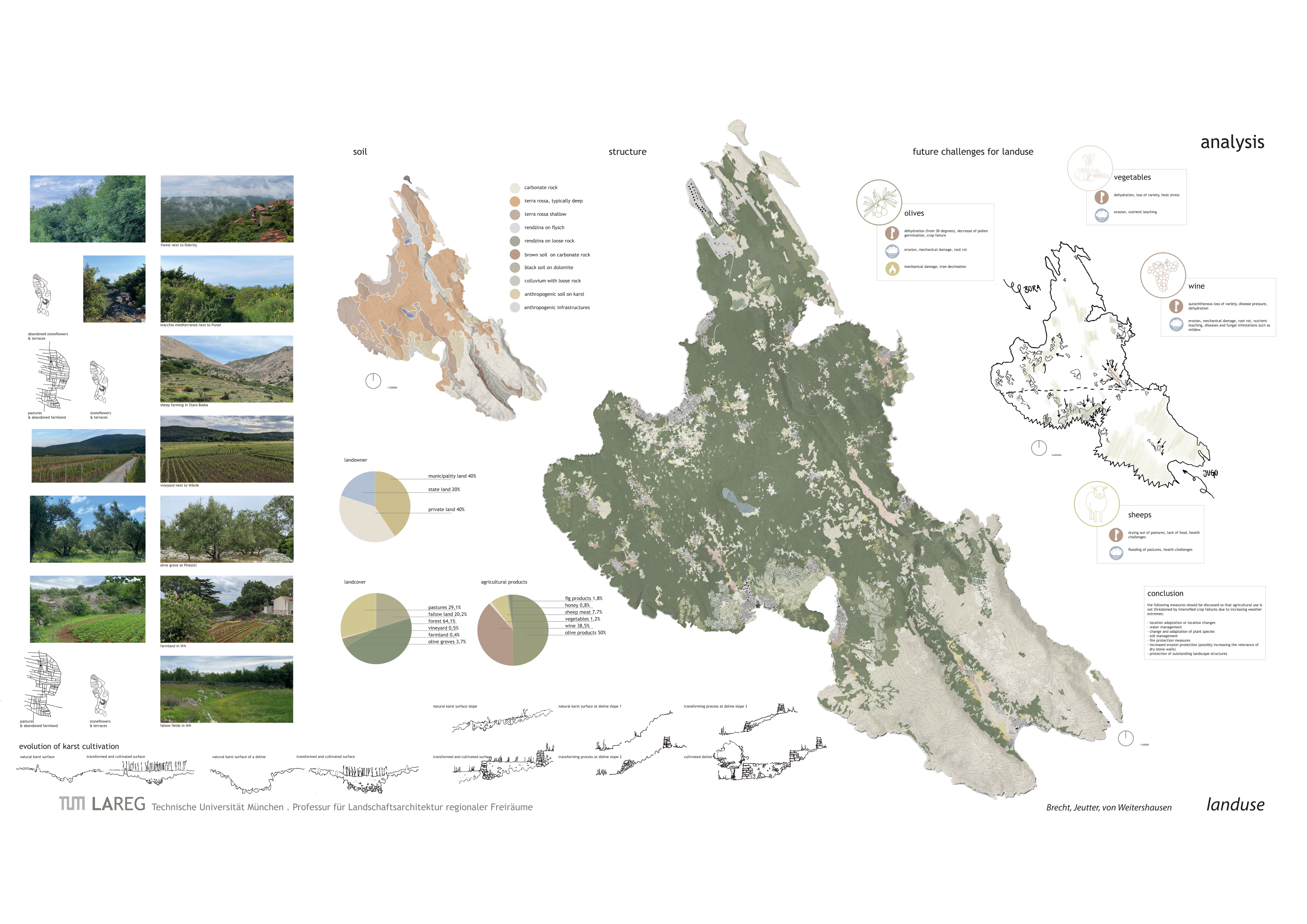
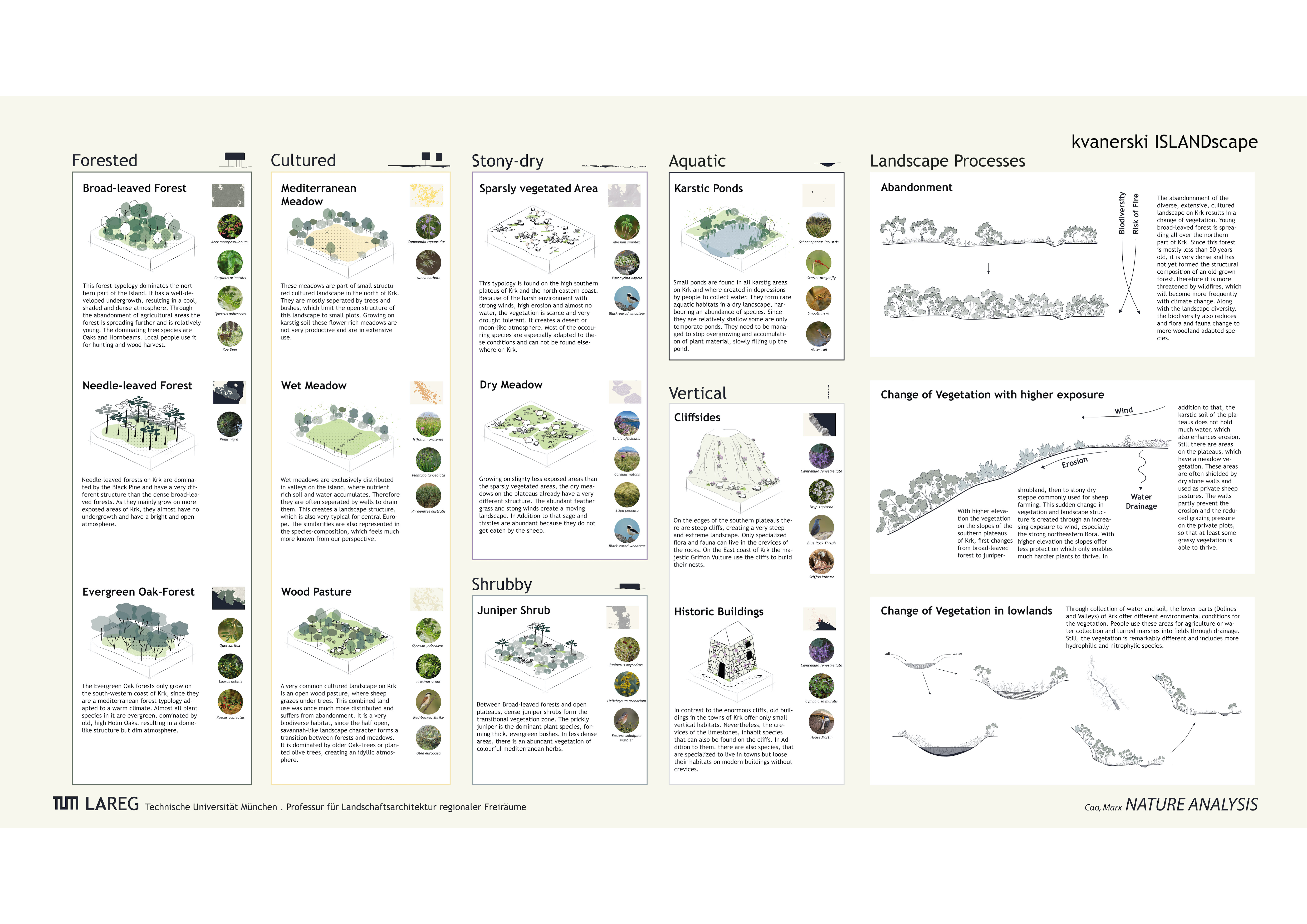
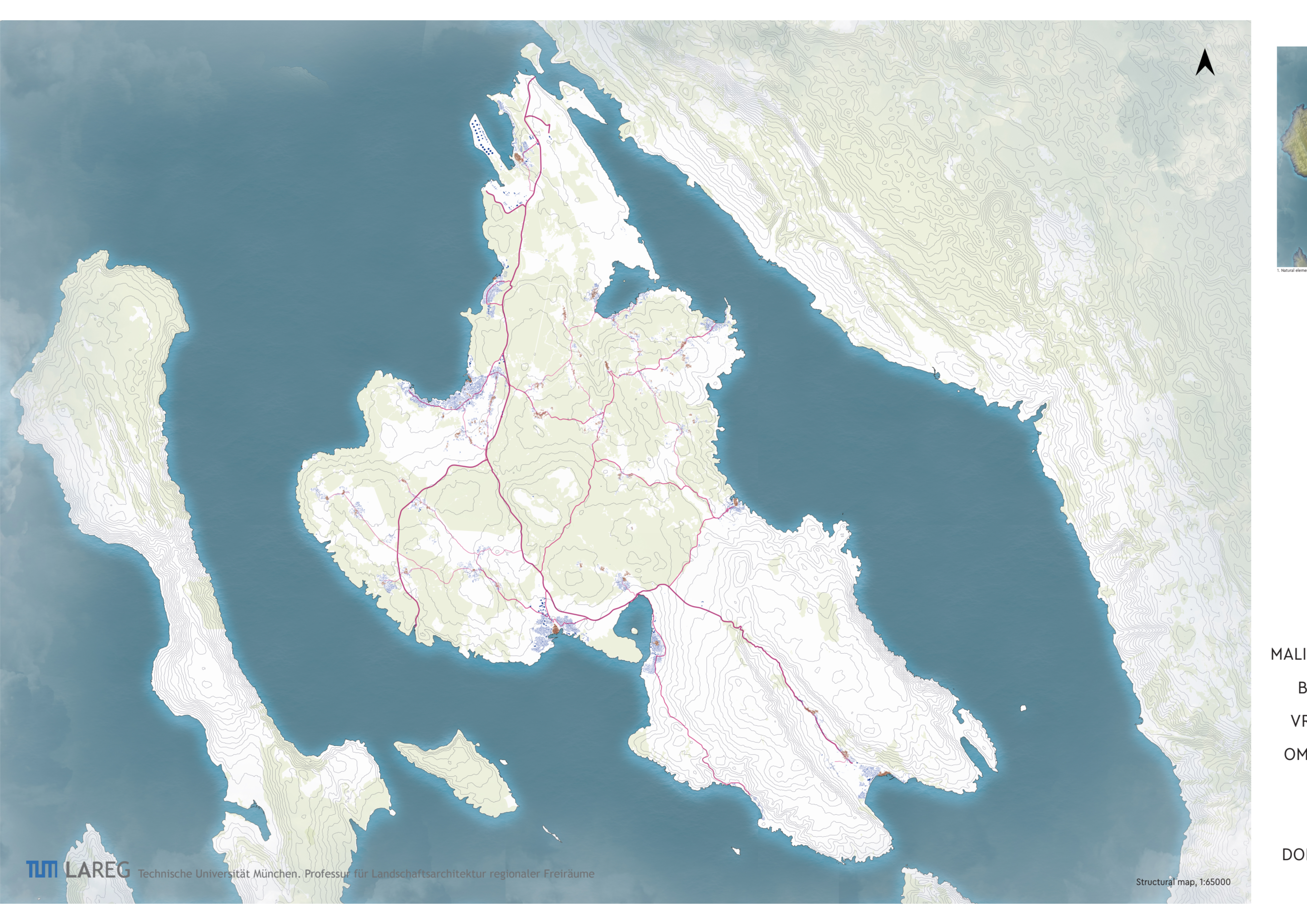
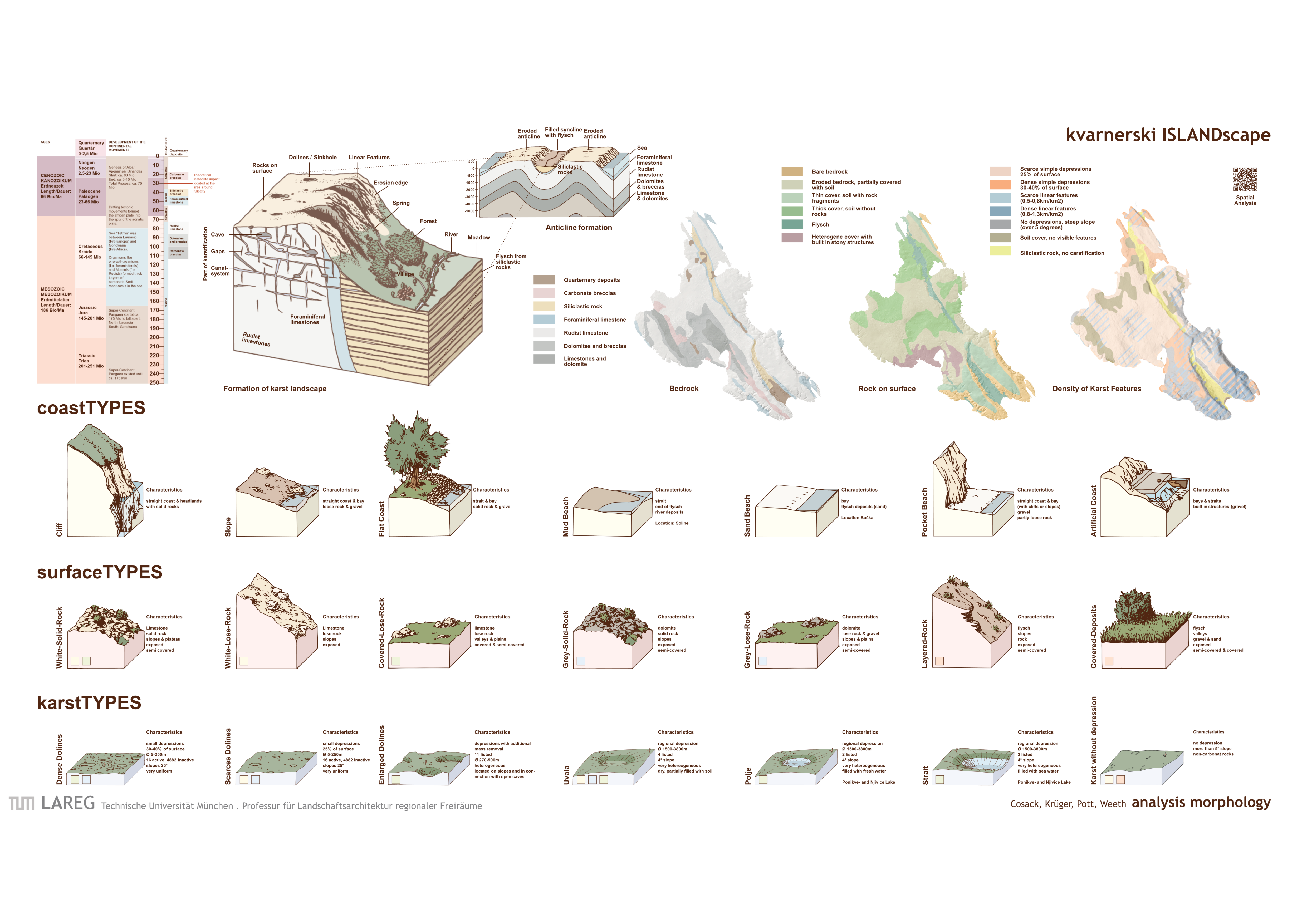
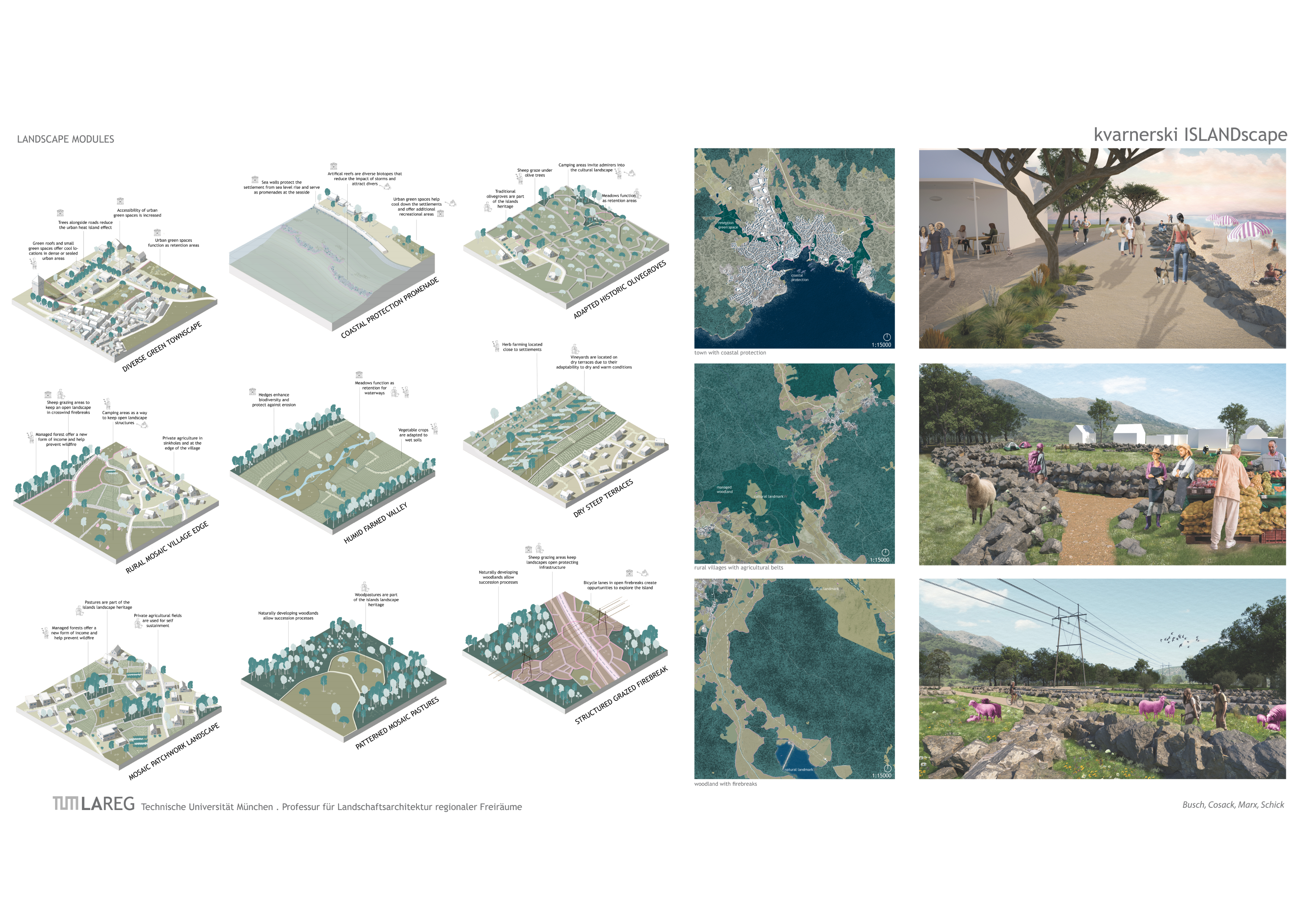
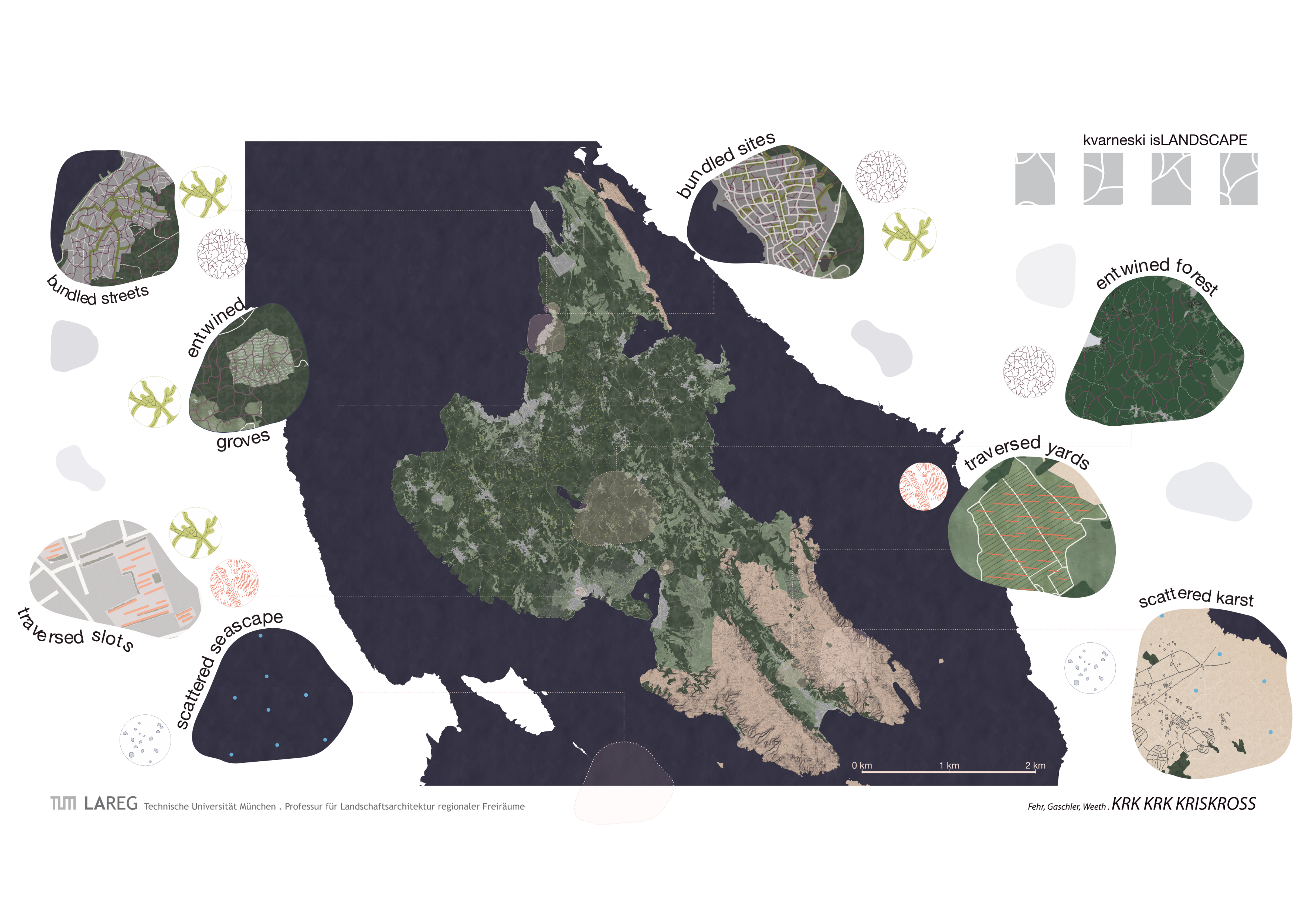
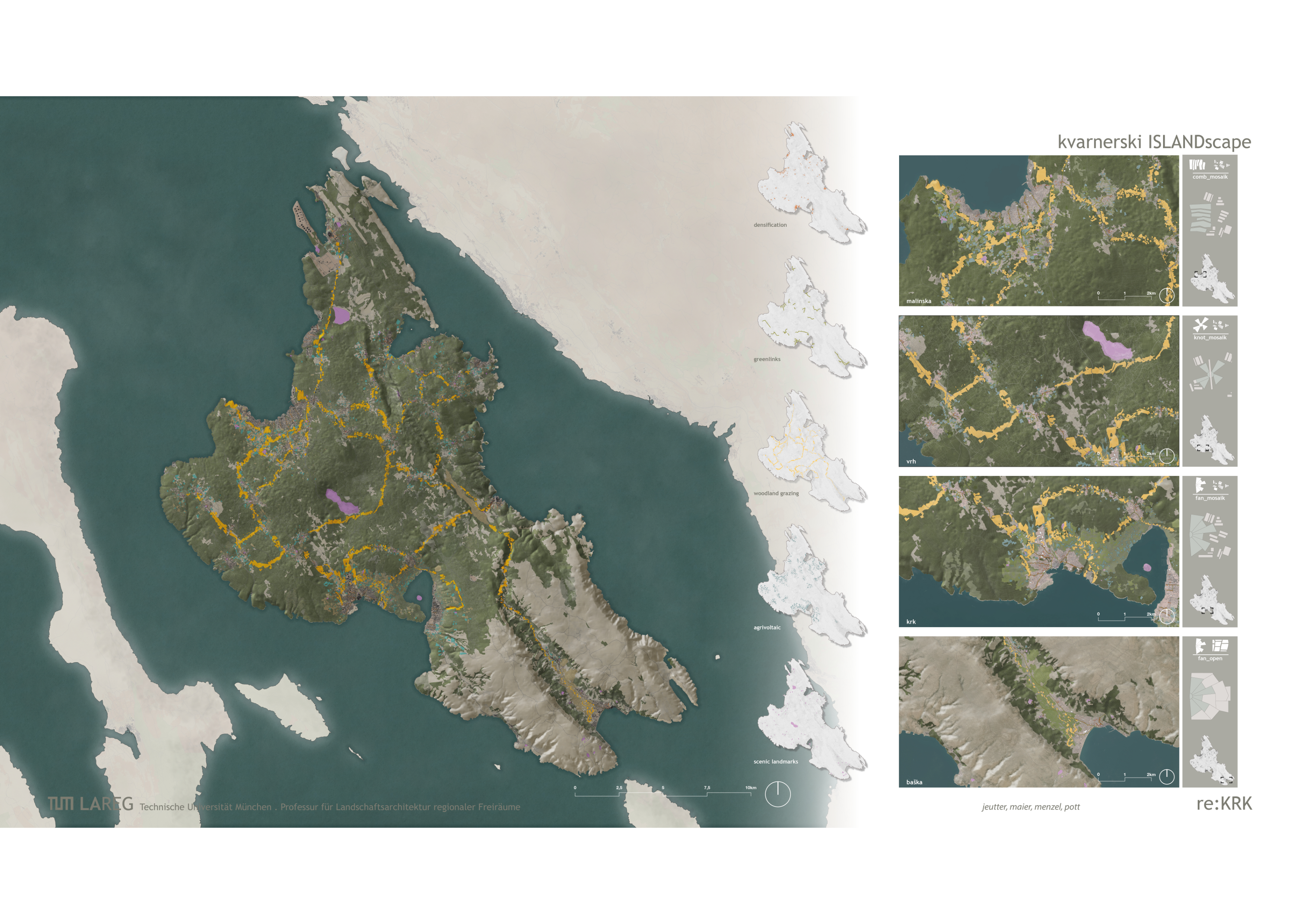
Analysis


Task Assignment
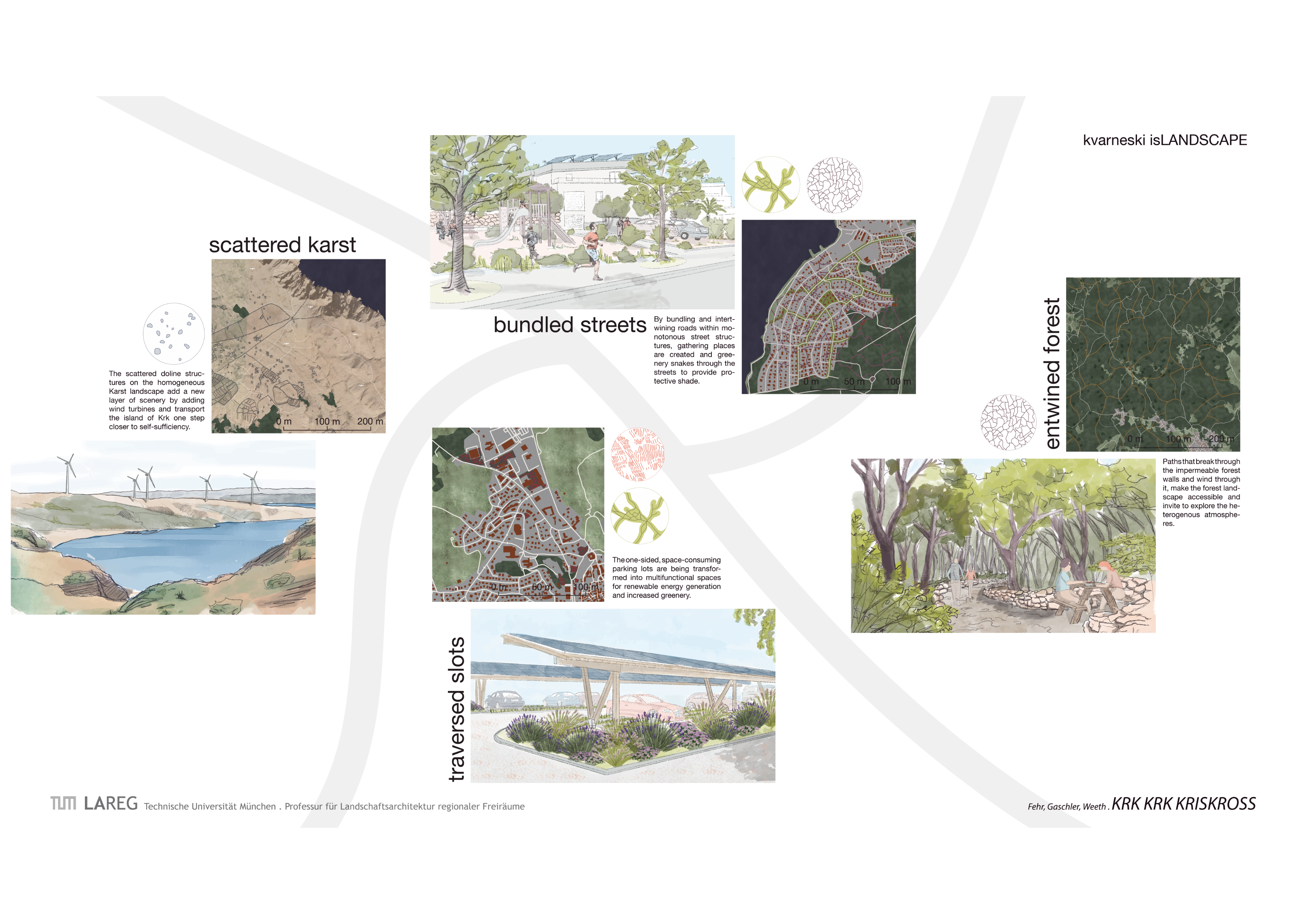
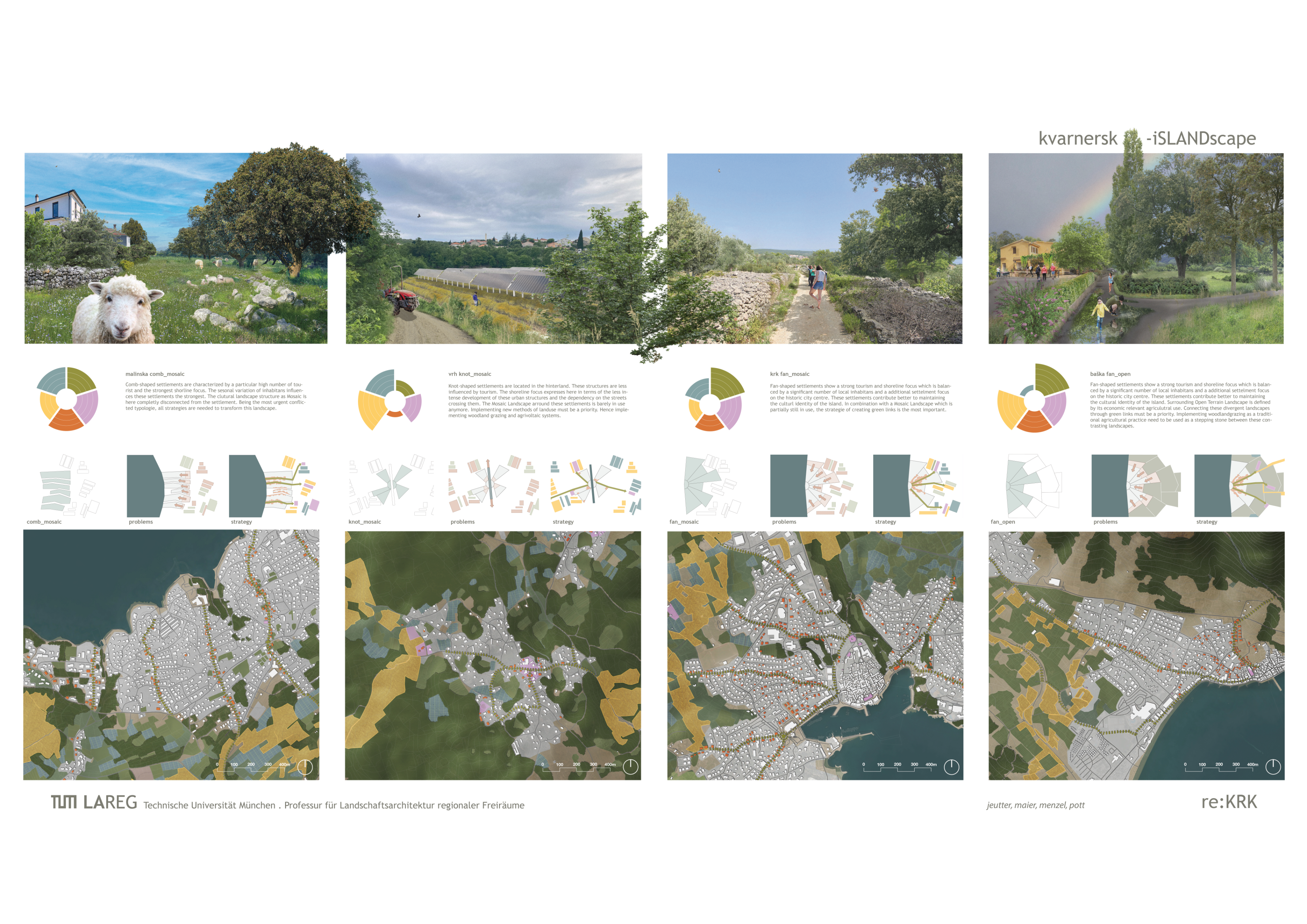
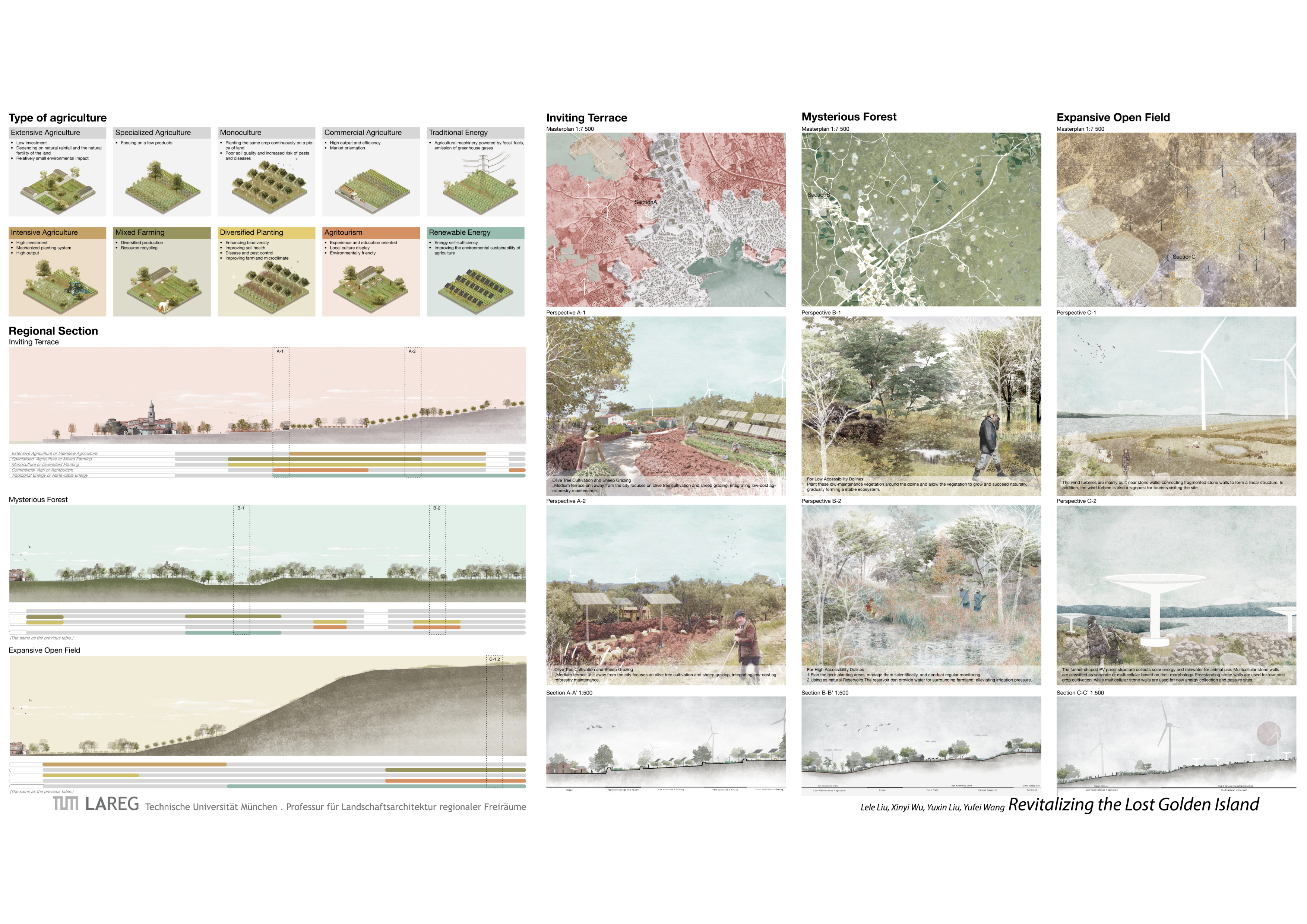
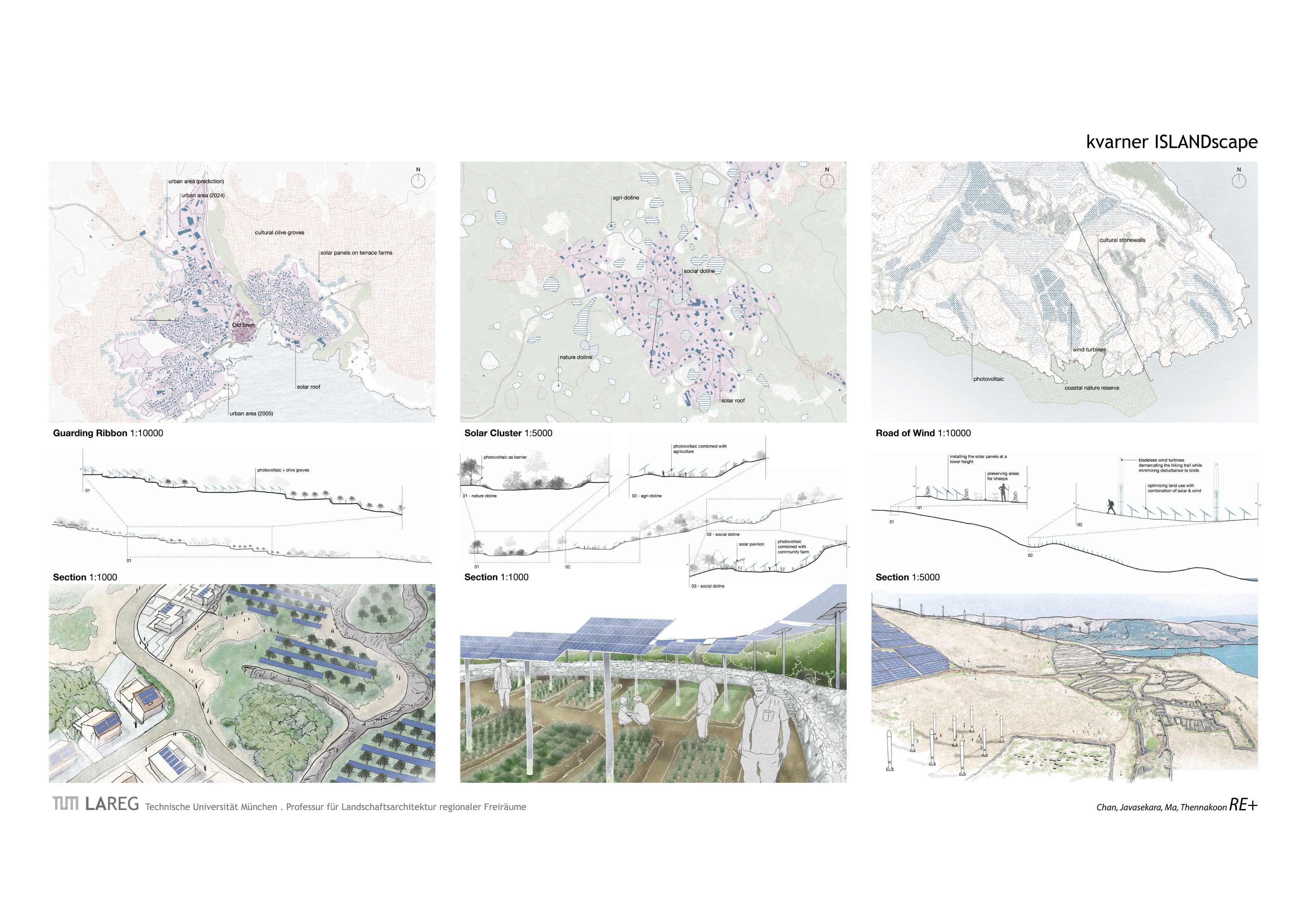
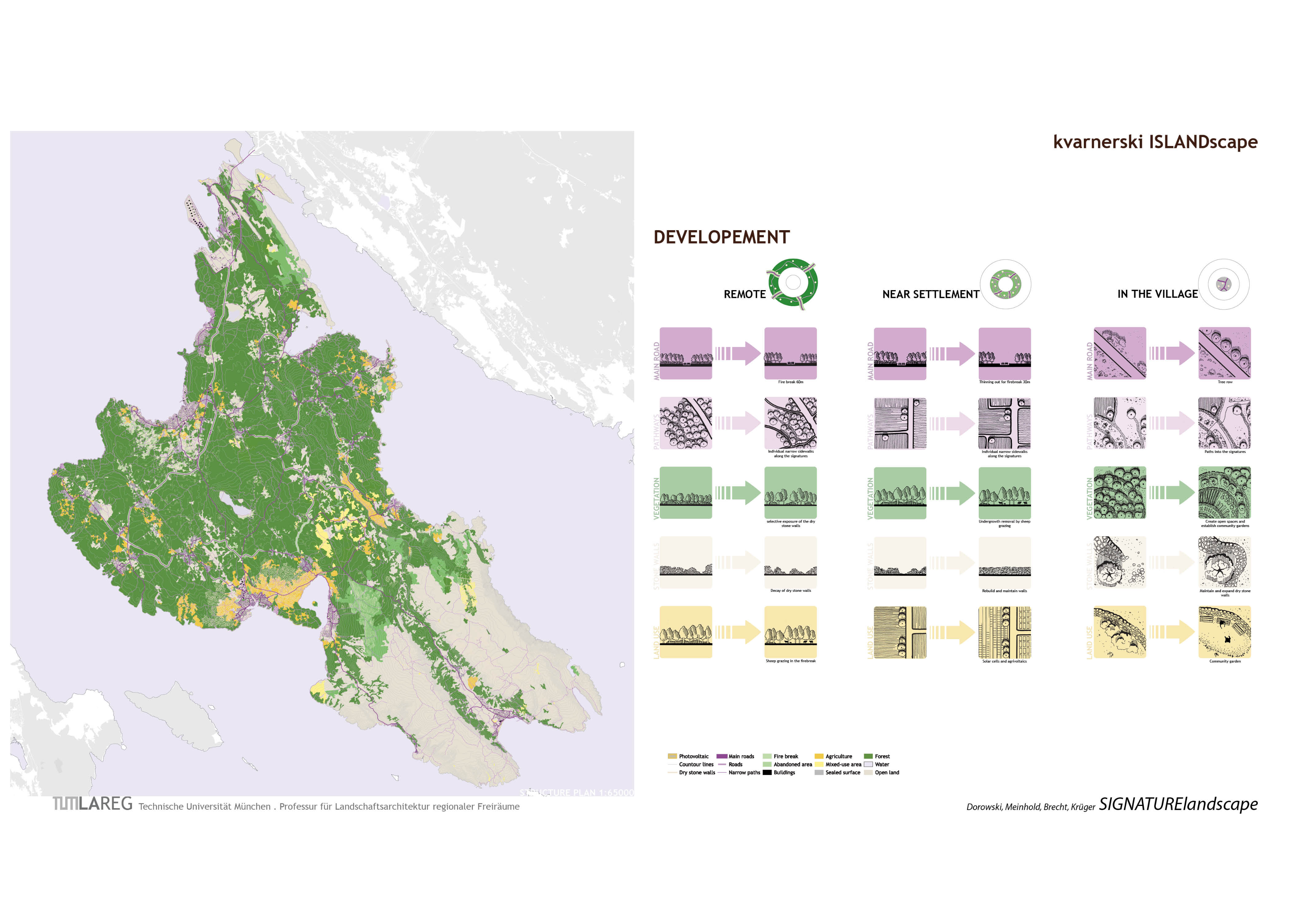
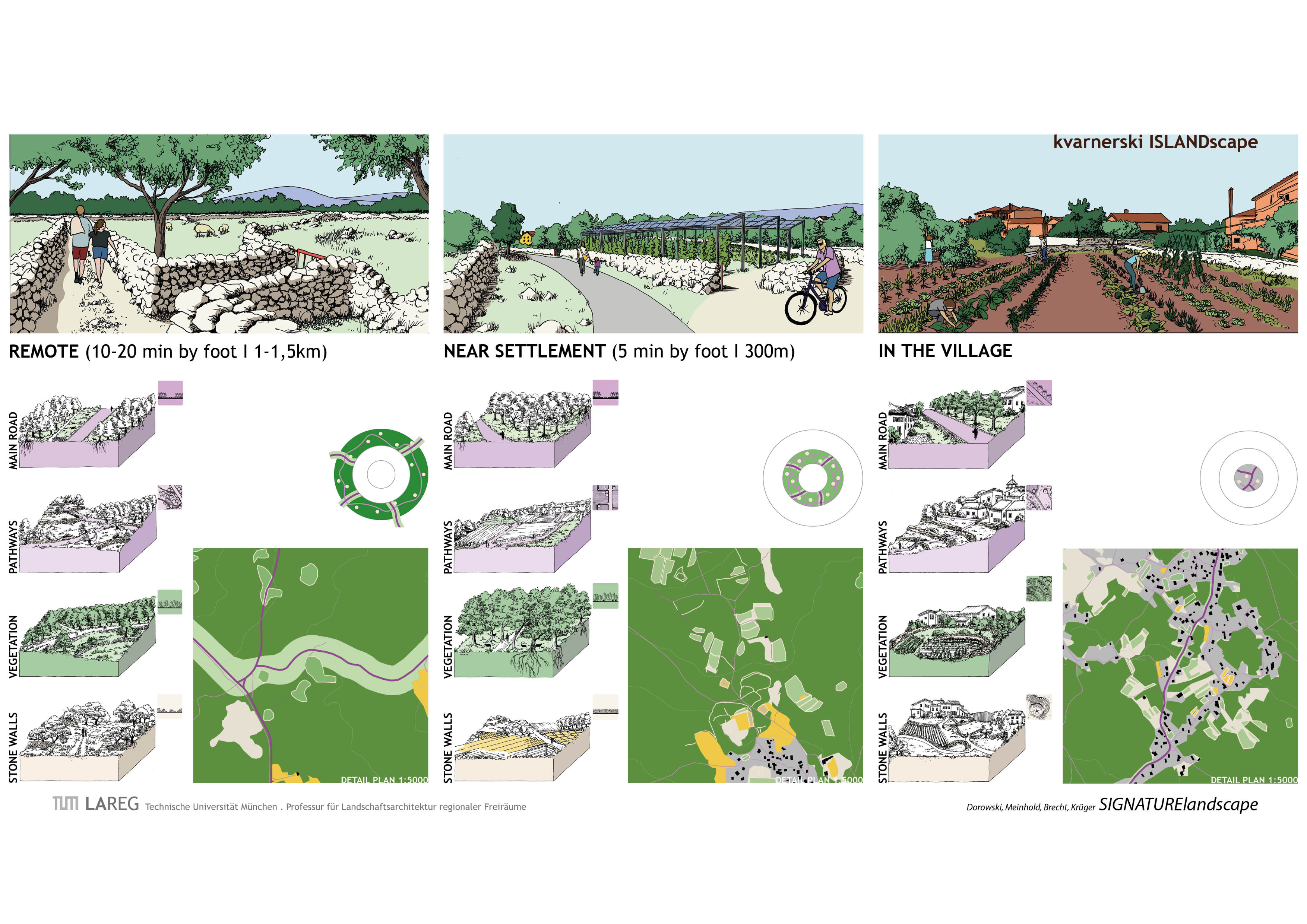
With this background, regional concepts are to be developed in the bachelor project, in which the development of the coasts - protection, tourism and infrastructure - are to be combined with adaptation strategies in agriculture and the construction of settlement expansions. After analysing the various landscape characteristics of the island, typological designs for the individual landscape areas are to be developed. These should be comprehensible as a landscape concept for Krk, as well as functioning on a small scale for individual places on the island.
Design
In the design, drafts of elements/structures and/or structural contexts were developed at regional, urban planning, object planning and/or detail level, always taking into account the concept developed and consistent landscape development.
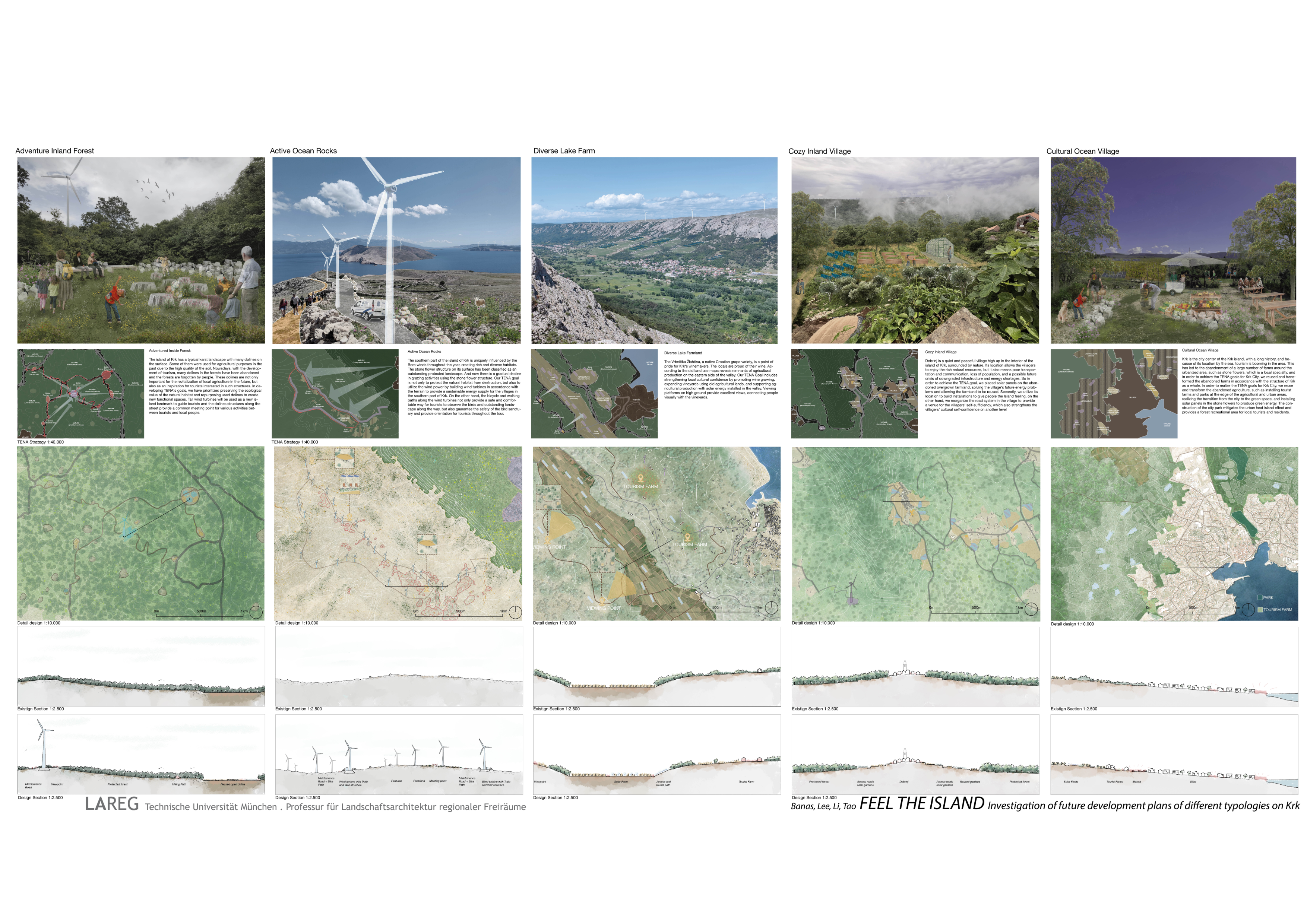


Approach and Implementation
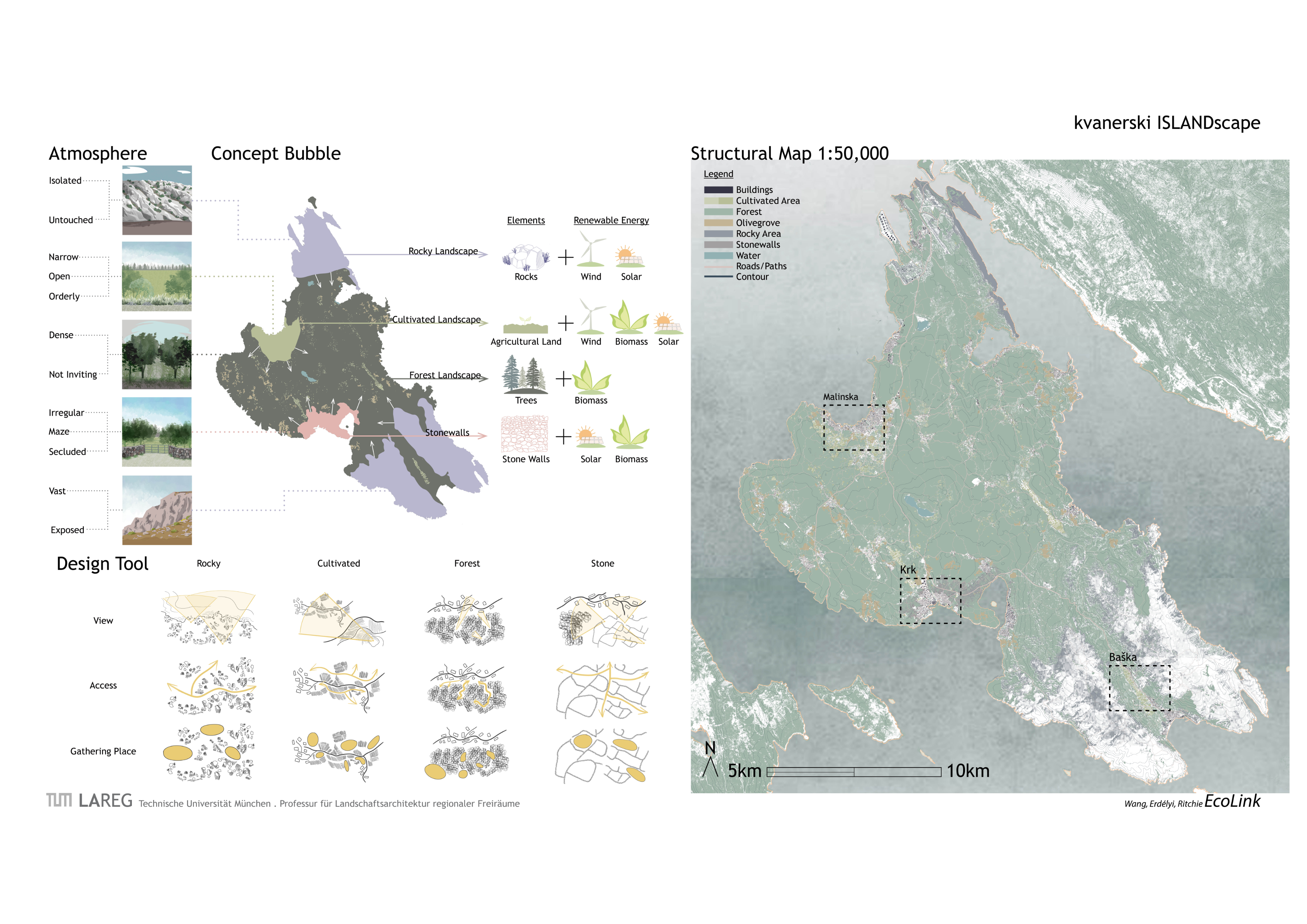
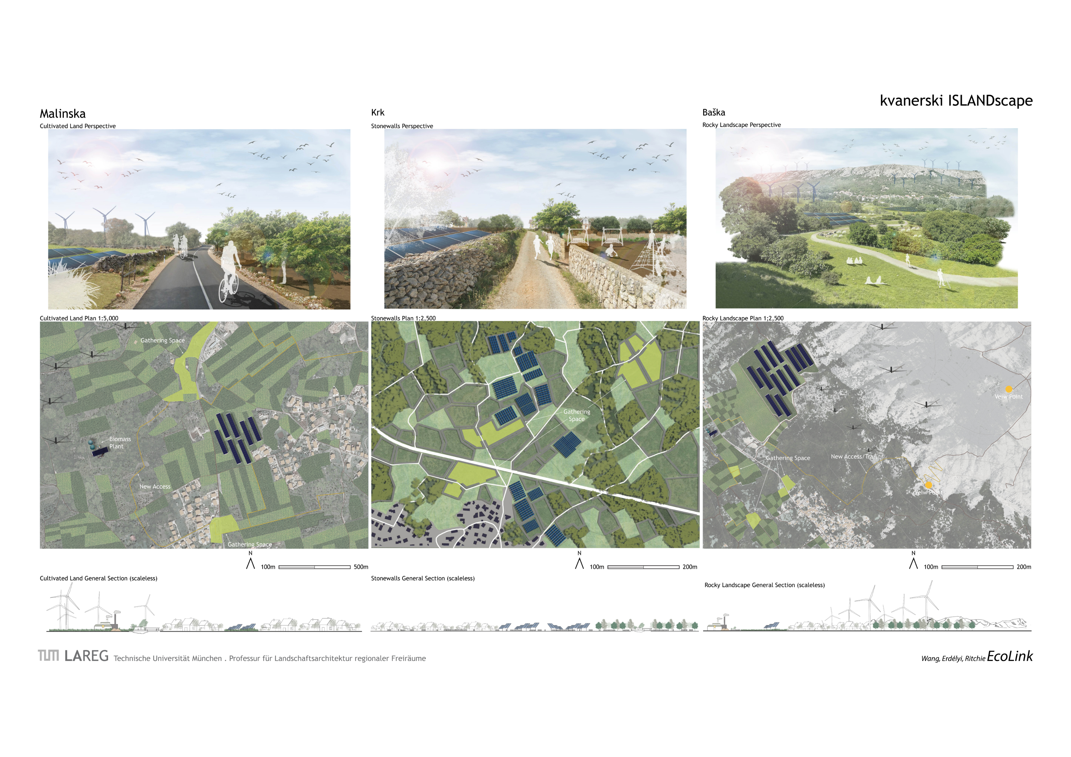
SKETCHING. Sketching spaces/landscapes with pencil on tracing paper over (topographical) maps and aerial photographs. Draw through, search for elements and form types.
ANALYSING. Digital character maps (qGIS) are created, the significance of the spaces/landscapes and the typical landscape elements that characterise them from your point of view are compiled.
CONSTRUTE. Elements and structures of renewable energies are captured in all their dimensions and varied as building blocks of landscape textures.
DESIGN. Merging and overlaying the digital data and sketched structures into landscape ideas.